
Archive

Drought Information and Management System
At a time when rains and floods continue to batter several parts of the country, it would seem misplaced to bring out an issue on Drought monitoring and

Trimble Blends Performance and Simplicity with New X7 3D Laser Scanning System
Innovative High-Speed 3D Laser Scanning System Simplifies Use, Increases Efficiency and Provides Confidence in the Field to Capture Digital Data SUNNYVALE, Calif., Sept. 16, 2019—Trimble (NASDAQ: TRMB) introduced today the Trimble®
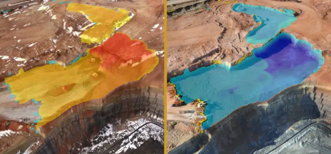
Virtual Surveyor to Unveil Enhanced Cut-and-Fill Mapping in Drone Surveying Package at InterGEO 2019
Faster, More Accurate Volume Calculations LEUVEN, Belgium, 10 September 2019 – Virtual Surveyor has added cut-and-fill mapping capabilities to Version 7.0 of its popular drone surveying package. The new functionality

Select and Download Sections of Large Point Clouds Right in Your Browser with NavVis IndoorViewer 2.5
The upcoming release of NavVis IndoorViewer 3D building visualization software will include a new feature to select, crop and download point cloud sections in browser. The beta version of the
