
Business
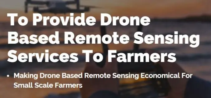
Farmonaut Partners With GarudaUAV to Provide Drone-Based Remote Sensing Technologies for Farming in India
Farmonaut has come together with a leading Indian drone services company, GarudaUAV, engaged in aerial data acquisition, analysis, and reporting for the promotion of drone-based remote sensing technologies for farming
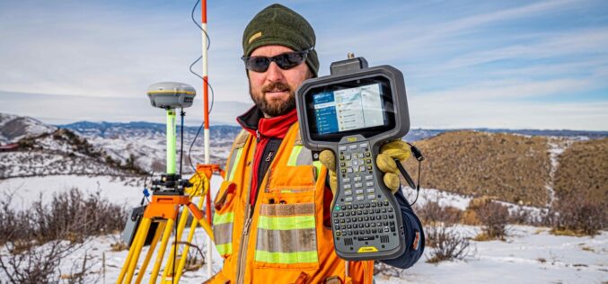
Trimble Announces Trimble TSC5 Controller, a Rugged, Lightweight Field Data Controller for Land and Construction Surveying
Trimble TSC5 Controller with 5-inch Screen, Keypad and Android Operating System Enables All-Day Field Data Collection in Harsh Environments Trimble (NASDAQ: TRMB) introduced today the Trimble® TSC5 Controller, a new

Transerve Transforms itself as Location Intelligence Platform Provider
Moving away from process-based architecture to value-based architecture; Transerve transforms its business from being a civic-tech company, to a location intelligence technology provider. As economic activity rebounds from the COVID-19
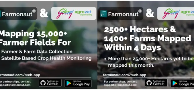
Farmonaut to Provide Its Services to Godrej Agrovet in Mapping 15000+ Farmer Fields
Farmonaut is all set to work with Godrej Agrovet to help them map more than 30000 hectares using its technology. Farmonaut, a satellite-based crop health monitoring start-up with headquarters in
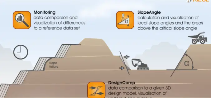
RIEGL VZ-i Laser Scanners Support the Step Towards the “Remote Operated Digital Mine”: Easy-to-use, Intuitive Mining Apps for Autonomous Data Acquisition and Processing
Remote Operation is the keyword of our time, even applying itself to the mining industry. The VZ-i Series of 3D terrestrial laser scanners are ready to meet the demanding challenges
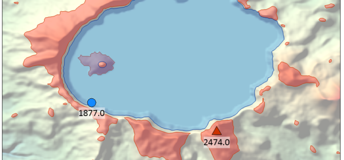
Golden Software Enhances Surfer Visualization Functionality for Deeper Data Insights
Golden Software, a developer of affordable 2D and 3D scientific modeling packages, has enhanced visualization and other functionality in the new version of its Surfer gridding, contouring and 3D surface
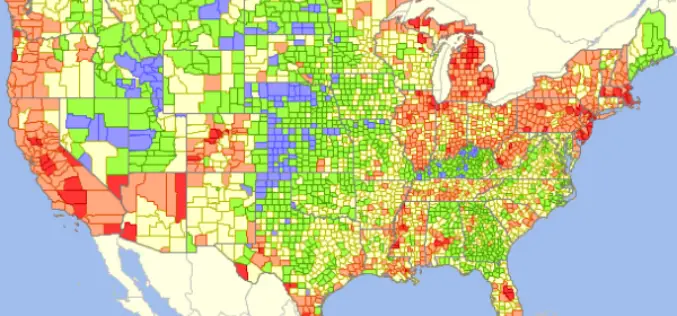
GIS Analytics Server of U.S. Federal Statistical Data
The Visual Data Analytics (VDA) Mapserver is a web-based, interactive mapping and geospatial analysis resource for U.S. Federal statistical data that is developed from the TatukGIS Developer Kernel for ASP.NET
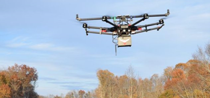
3D Laser Mapping Benefits Corridor Monitoring
RedTail LiDAR Systems offers safe, efficient solution RedTail LiDAR Systems recently partnered with an award-winning engineering firm to demonstrate the RTL-400 LiDAR system’s high-resolution, high accuracy mapping capability. Light detection and ranging
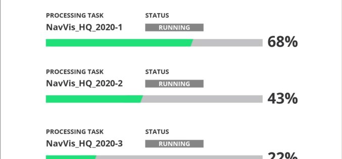
NavVis Introduces Cloud Processing for Even Faster Laser Scanning Workflows
From processing to viewing, with NavVis it can now be done entirely in the cloud. NavVis, an innovator in indoor mobile mapping, today introduced the Cloud Processing Add-on for NavVis
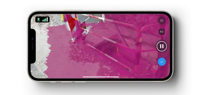
Pix4D Launches New Ground Image Capture App for 3D Modeling With the iPad Pro and iPhone 12 Pro
Pix4D, the photogrammetry industry leader, announces today the release of a new app product for ground images acquisition: Pix4Dcatch. Pix4Dcatch empowers users to easily create ground-based 3D models using an
