China Announces In-Orbit Upgrade for BeiDou Satellite Navigation System in 2026

China’s BeiDou Navigation Satellite System (BDS) is set to undergo a significant in-orbit upgrade, the China Satellite Navigation Office announced on 13 March 2026. The upgrade will improve signal accuracy, service reliability, and Precise Point Positioning (PPP) capabilities for both civilian and professional geospatial users worldwide. The development marks a major step in BeiDou’s evolution as a full peer to the US GPS, European Galileo, and Russian GLONASS satellite navigation constellations.
Background: BeiDou Satellite Navigation System and Global GNSS Competition
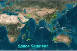
BeiDou has grown from a regional navigation experiment into the world’s largest satellite navigation constellation. The BDS-3 constellation, completed in 2020, comprises 30 operational satellites in three orbital regimes: Medium
Also Read – Understanding China’s BeiDou-Only Mandate: Strategic and Global Implications
BeiDou Satellite Navigation Upgrade: Technology and Methodology
The in-orbit upgrade focuses on three key technical enhancements to BeiDou’s satellite navigation performance.
PPP-B2b Signal Enhancement and Satellite Navigation Accuracy
The primary upgrade targets the PPP-B2b signal — BeiDou’s dedicated channel for Precise Point Positioning (PPP) corrections broadcast directly from the satellites. PPP enables standalone receivers to achieve positioning accuracy of better than 10 centimetres in the horizontal plane without relying on a local ground-based reference station network, making it transformative for precision agriculture, autonomous vehicles, and land surveying in remote areas. The upgraded PPP-B2b service is expected to achieve horizontal accuracy approaching 0.3 metres without augmentation — a significant improvement over the current service. Additional upgrades include enhanced inter-satellite link (ISL) ranging between BDS-3 MEO satellites, which enables autonomous orbit determination and clock correction without ground station contact, improving both accuracy and resilience. The upgrade also strengthens anti-spoofing capabilities through improved signal authentication protocols for high-security users.
Implementation: Global Constellation and Service Area
The in-orbit upgrade is applied across the entire BDS-3 MEO satellite segment — 24 satellites in circular orbits at approximately 21,528 km altitude — using secure telecommand uplinks from China’s ground control network centred at the Beijing Aerospace Control Centre (BACC). No additional satellite launches are required; the upgrade is software-based, pushed to existing payloads. Service improvements are expected to be progressively activated from the second quarter of 2026, with full enhanced PPP-B2b capability available globally by year-end. Asia-Pacific users — including those in South and Southeast Asia — will experience the greatest immediate benefit, as the GEO and IGSO satellites provide enhanced signal power over this region.
Applications and Impact
The upgraded BeiDou satellite navigation system will benefit a wide range of geospatial applications. In precision agriculture, sub-metre PPP positioning enables autonomous tractor guidance, variable-rate fertiliser application, and yield mapping without the cost of installing local CORS (Continuously Operating Reference Station) networks. In land surveying, improved PPP accuracy expands the viability of single-receiver surveys in remote terrain. For shipping and maritime navigation, stronger anti-spoofing protocols will be critical in contested waters. Geospatially, BeiDou’s upgrade strengthens the case for multi-constellation GNSS receivers that combine BDS, GPS, Galileo, and GLONASS — improving redundancy and overall positioning integrity globally.
Conclusion
China’s BeiDou satellite navigation in-orbit upgrade reinforces the system’s standing as a world-class GNSS constellation. With PPP accuracy approaching 0.3 metres and enhanced anti-spoofing capabilities, BeiDou’s 2026 enhancements will accelerate adoption across precision geospatial applications — and intensify the global competition to deliver the most accurate and resilient satellite navigation services for the next generation of users.
References
1. People’s Daily. “China’s BeiDou Navigation Satellite System to undergo in-orbit upgrade.” 13 March 2026. https://en.people.cn
2. China Satellite Navigation System Management Office (CSNO). BDS-3 System Specifications. http://www.beidou.gov.cn
3. European GNSS Agency (EUSPA). GNSS User Technology Report 2024. https://euspa.europa.eu
4. Qazinform. “China targets real-time global coverage with 1,000-satellite network.” 13 March 2026. https://qazinform.com