NASA ARSET Training Opportunity for Coastal Mapping: Coastal Laser-Altimetry
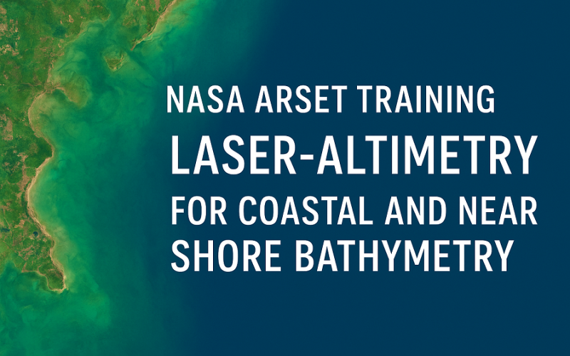
The NASA Applied Remote Sensing Training Program (ARSET) is inviting remote-sensing professionals and geospatial analysts to join a live online training titled “NASA Satellite Laser Altimetry for Coastal and Near-Shore Bathymetry”. The free instructor-led event focuses on how to use satellite laser data for mapping shallow water zones — a key emerging capability.
What the training covers
Participants will explore how the ICESat‑2 mission and its onboard laser instrument ATLAS can be applied in near-shore environments. The training shows how the ATL24 product offers along-track bathymetry and sea surface heights in shallow marine areas.
Attendees will learn to download and plot ATL24 data using the SlideRule Web Client, and analyse it using the SlideRule Python Client.
The sessions will cover both theory and hands-on demonstrations: part one gives an overview of mission/data, part two dives into processing methods and integration with other tools (e.g., QGIS, multispectral imagery).
When and how
The training takes place on December 2 and December 4, 2025, in two daily time slots to accommodate global participants:
- Session A: 10:00-11:30 a.m. EST (UTC-5)
- Session B: 2:00-3:30 p.m. EST (UTC-5)
Both sessions cover identical material.
Registration is open at no cost, and attendees who complete all parts and the homework will receive a certificate.
Who should attend?
This training on coastal laser-altimetry is aimed at remote-sensing scientists, geospatial analysts from public, private and international institutions, academics, and those working in marine navigation, near-shore habitat research, and coastal engineering.
Prerequisites include a basic understanding of remote sensing and familiarity with mapping and monitoring water bodies via satellite platforms.
Why this matters
Coastal zones are dynamic and vulnerable, and shallow-water bathymetry is vital for navigation safety, habitat mapping, coastal risk reduction and engineering design. The concept of coastal laser-altimetry unlocks new ways to derive bathymetric depth data from space-based lidar in regions where traditional surveys may be challenging. For example, ATLAS’s green-wavelength photon-counting lidar can reach depths up to about 40 m in sufficiently clear water.
By attending, professionals can gain hands-on skills in accessing, visualising and analysing this cutting-edge data — improving capacities for coastal management, resilience and scientific research.
Take-away
Don’t miss out on this timely training on coastal laser-altimetry. Whether you are working in marine or coastal geospatial fields, this course will expand your toolkit and awareness of satellite-derived bathymetry capabilities. Make sure to register early and prepare for the two-part online sessions.
Source: NASA Earthdata