 There are two methods of GPS (Global Positioning System) data processing. These are Post Processing and Real-Time Processing. The post-processing method involves downloading complete survey data and processing it in office.
While Real-time processing of GPS data involves the processing of data in real time or say when the GPS survey is going on. The method of Real-Time Processing of DGPS data is also known as Real Time Kinematics (RTK) surveying method. The standard scenario for Real Time Kinematics (RTK) methods requires the surveyor to operate two GPS receivers (one reference receiver and another rover receiver), as well as the data link. Once set up, the reference receiver continuously transmits its carrier phase measurements to the roving receiver. The software within the `roving’ receiver’s microprocessor then tries to resolve the ambiguities in the shortest time possible (using the OTF-AR algorithm), and resulting `carrier-range’ data is used to derive cm-level accuracy baseline results.
RTK is especially vulnerable to poor satellite visibility, multi-path and unreliable data links from reference stations.
The method of post-processing data is not vulnerable to the above limitations; it even provides much better positional accuracy. Eight popular post-processing free services are available. These services take advantage of both the IGS Stations Network and the IGS product range and work with data collected anywhere on Earth.
Following are the eight most popular GPS Post Processing Services:
1. AUSPOS:
AUSPOS is a free online GPS data processing service provided by Geoscience Australia
- AUSPOS takes advantage of both the IGS Stations Network and the IGS product range, and works with data collected anywhere on Earth
- Users submit their dual frequency geodetic quality GPS RINEX data observed in a ‘static’ mode to your GPS data processing system
- An AUSPOS report will be emailed to you (often in less than five mins) containing Geocentric Datum of Australia 1994 (GDA94) and International Terrestrial Reference Frame (ITRF) coordinates.
2. Trimble CentrePoint RTX Post Processing:
Trimble RTX™ is a global GNSS technology providing centimeter-level positioning accuracy, worldwide, at any time.
This application allows you to upload GNSS observation data to the CenterPoint RTX post-processing service and receive positioning calculations. The positioning calculations are performed in ITRF2008 current epoch. Transformation can be performed by selecting a different coordinate system and tectonic plate.
- <2cm Horizontal Accuracy
- GNSS Compatibility
- No Base Station Required
CentrePoint RTX Post Processing – Trimble
3. CSRS – Precise Point Positioning:
Canadian Spatial Reference System – Precise Point Positioning (CSRS-PPP) is an online application for GNSS data post-processing that allows users to submit observation data over the Internet and recover, using precise GNSS Orbit and Clock information, enhanced positioning precisions in the Canadian Spatial Reference System (CSRS) and the International Terrestrial Reference Frame (ITRF).
4. Scripps Orbit and Permanent Array Center (SOPAC) – Scripps Coordinate Update Tool (SCOUT):
The Scripps Coordinate Update Tool (SCOUT) can be used to compute mean coordinates of a specific site, by submitting a RINEX file of a particular day.
- SCOUT uses ultra-rapid orbits to allow near-real-time data processing
- SCOUT supports these GPS models only. Do not use RINEX files from other models.
- SCOUT limits users to 10 uncompleted (queued) jobs at a time. Average run time is 30 minutes. SCOUT now launches jobs to multiple servers (when available) to reduce wait times.
5. Automatic Precise Positioning Service (APPS) – Jet Propulsion Laboratory
APPS accepts GPS measurement files, and applies the most advanced GPS positioning technology from NASA’s Jet Propulsion Laboratory to estimate the position of your GPS receivers, whether they are static, in motion, on the ground, or in the air. APPS employs:
- Real-time GPS orbit and clock products from JPL’s GDGPS System
- JPL’s daily and weekly precise GPS orbit and clock products
- JPL’s GIPSY-OASIS software for processing the GPS measurements
APPS supports input in RINEX 2, RINEX 2.11 input files, GIPSY TDP files.
6. Online Positioning User Service (OPUS):
This Online Positioning User Service provides simple access to high-accuracy National Spatial Reference System (NSRS) coordinates. Upload a data file collected with a survey-grade GPS receiver and obtain an NSRS position via email.
OPUS requires minimal user input and uses software which computes coordinates for NGS’ Continuously Operating Reference Station (CORS) network. The resulting positions are accurate and consistent with other NSRS users.
7. GPS Analysis and Positioning Software (GAPS):
Precise point positioning (PPP) is one of the existing techniques for determining point coordinates using a GPS receiver. In this technique, observations produced by a single receiver are used to determine the receiver’s location as well as other parameters such as receiver clock and total neutral atmosphere delay. The GPS Analysis and Positioning Software (GAPS) was initially developed at the University of New Brunswick by Rodrigo Leandro. Additions to the source code of the online version have been made by Landon Urquhart and Carlos Alex Garcia.
Although mainly used for positioning, GAPS was designed and built as a veritable “Swiss Army Knife” for GPS data processing, allowing the user to estimate ionospheric delays, code biases, satellite clock errors and code multipath.
8. magicGNSS/PPP:
The email version of magicGNSS/PPP (Precise Point Positioning), allows the processing of static and kinematic GPS and GLONASS real-time data in RINEX format. Only dual-frequency PPP is supported at the moment.
Real-time GPS and GLONASS orbits and clocks needed by PPP are generated internally. Satellite clock rate is 5 min. Rapid and final GPS orbits and clocks from IGS are also used, if available. Final IGS clock rate is 30 sec.
Note: There is one thing common in all online GPS Processing Services is that all services using RINEX file format as input file standard fromuser end.
Read more about RINEX file format and download a sample of RINEX file.
Read related article:
- Introduction to GPS
- Fundamentals of GPS Signal And Data
- GPS Field Observation and Data Processing
- GPS Surveying Techniques
- Possible Applications of GPS



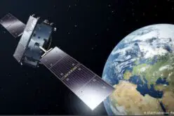
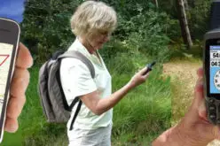





PPP technique does not derive an accuracy better than RTK but is less in cost and equipment
liked the feed very helpful
Three of you links are dead, and so give “not found” error page:
http://sopac.ucsd.edu/cgi-bin/SCOUT.cgi
http://gaps.gge.unb.ca/indexv520a.php
http://magicgnss.gmv.com/ppp/
The Trimble link you gave has not responded after 2 hours.
The AUSPOS link gave an error but did not say why.
Three of your links above worked well: the JPL, the OPUS, and the Canadian one.
Hi Erik,
Thanks for letting us about that some service URLs are not working. We have updated GAPS and SOPAC websites. But seems MagicGNNS service is not working.
All your links work now even MagicGNNS it must have been off that day. The SCOUT site requires ftp uploading, which the web says Macs and Google chrome can’t do. I also could not find anyplace on the MagicGNNS website to upload. Of the remaining links only the JPL, OPUS and the Canada sites have emailed me back data, but I have not waited more than three days since data collection so they might require up to 2 weeks. The JPL site replies instantly after data collection and upload, and they claim an incredible accuracy of just a few millimeters this morning of sigmaLat=0.0046m sigmaLong=0.0036m., almost at the accuracy range of my laser theodolite The Canadian site claims only around a decimeter accuracy, but they send detailed graphs of data, which I find useful to see if there were obstructions to the sky, etc.. It will take a month or so for me to check the actual accuracy of these websites and how realistic their sigmas were.
Hi Erik, thanks for the information and for sharing your observation with respect to different platforms.
Results of my tests:
(the JPL site rejected all my data files this week so I had to leave them out)
To check accuracy I compare new GPS measurements from the last few weeks with my laser distance measurements with my Theodolite.
For example back in 2017 I measured the distance between two hole I drilled
into bedrocks on my front lawn as
survey #129:
Drill#5= -100.829 feet East, -16.958 feet North
Drill#6= -104.150 feet East, -8.018 feet North
So the distance between them is 2.90685 meters.
Then a few months ago, four years latter, I remeasured them as
Drill#5= -100.839 feet East, -16.959 feet North
Drill#6= -104.155 feet East, -8.016 feet North
the distance then is 2.907177 meters.
so those two laser distance measurements only differ by 0.3mm
Measuring the same points with GPS is a lot harder to get accurate.
I put the GPS receiver/recorder over the point and then, when its done, send
the data from its memory card to three or four different
national GPS processing websites.
Two of them “OPUS” and “Jet Propulsion Laboratory”
are in the United States, one is in Canada called “CSRS”
and one is in Australia called “AUSPOS”.
This “gisresouces.com” website introduced me to the “CSRS” site which I had never hear of before, an is one of the most useful.
Here are the coordinates they sent me for the same points
I had measured with the laser:
The Canadians at the “CSRS” company gave:
Drill#5
Latitude: +41º12’34”.98679 Longitude: -73º32’47”.47123
Drill#6
Latitude: +41º12’35”.07568 Longitude: -73º32’47”.51452
which means they think the distance between
the two points is 2.92185 meters, which is 15mm too big, but quite good for GPS.
The Americans at the “OPUS” company gave:
Drill#5
Latitude: +41º12’34”.98721 Longitude: -73º32’47”.47103
Drill#6
Latitude: +41º12’35”.07656 Longitude: -73º32’47”.51398
which means they think the distance between
the two points is 2.93246 meters, which is 25mm too big (about 1 inch).
The Australians at the “AUSPOS” company gave:
Drill#5
Latitude: +41º12’34”.98673 Longitude: -73º32’47”.47116
Drill#6
Latitude: +41º12’35”.07638 Longitude: -73º32’47”.51426
which means they think the distance between
my two points is 2.94235 meters, which is 35mm too big.
END of Test Results
Erik, thank you for sharing detailed analysis of results from different post processing websites. Hope your findings will be useful for other GNSS users. And we are happy to know that GIS Resources helped you by introducing “CSRS” website.