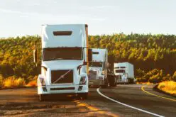
Logistics and supply chains increasingly utilize geospatial technology. This provides real-time data for key decisions like cutting transport costs. Geospatial tech enables route optimization and faster deliveries. It drives supply chain efficiency through data-based insight.
One area where geospatial technology is gaining popularity is the optimization of polyethylene transporter tanks, such as those found at The Water Tank Factory. Let’s delve into how this blend of technology and practicality works.
Geospatial Technology Explained
Geospatial technology includes GPS, GIS, RS, and other techniques for geographic data. It captures, stores, analyzes, manages, and presents location-based information. The technology uses seismic waves or ultrasound to map the earth’s surface and interior. For logistics like polyethylene transporter tank delivery, geospatial data provides key insights. This allows for data-driven decision making.
Significance
of Polyethylene Transporter Tanks
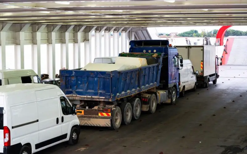
Polyethylene transporter tanks are durable storage solutions designed for transporting water, diesel, or any other liquid from one location to another. They offer several benefits over traditional steel tanks due to their lightweight nature and high resistance to rust and corrosion. Also known for their durability, these tanks can withstand rough handling during transportation without getting damaged.
The Role of Geospatial Technology
The main role of geospatial technology in optimizing polyethylene transporter tanks lies in route planning. With real-time location data from GPS, operators can identify the shortest and safest route to deliver the tank content. Using GIS, they can analyze traffic patterns, environmental conditions, road conditions and consequently make better route decisions. This helps avoid delays and reduce fuel consumption, which in turn lowers the overall cost of operations.
Improvement of Dispatch Efficiency
Geospatial technology boosts dispatch efficiency in vital ways. It supplies route data to guide drivers safely and quickly. The tech also tracks driver locations in real-time. Thus, dispatchers can rapidly reroute around unexpected delays. With geospatial data, dispatchers optimize delivery time and driver safety.
Asset Protection
Polyethylene transporter tanks can represent a significant investment for many companies. Therefore ensuring their safety during transit is paramount. With geospatial technology, companies can now monitor the position of polyethylene transporter tanks in real time. This constant surveillance not only deters theft but also enables rapid response in case of any mishaps, offering invaluable asset protection.
Ensuring Environmental Sustainability
In recent times, the need for environmental sustainability cannot be overstated. Using geospatial technologies in the operation of polyethylene transporter tanks is an effective way to support sustainability initiatives. When transport routes are optimized, less fuel is used, leading to a reduction in carbon emissions.
Also, by avoiding traffic congestion and unsafe roads, companies can prevent unnecessary wastage of resources. Thus, geospatial technology offers a practical solution for aligning business activities with global sustainability goals.
Enhancing Customer Satisfaction
Customer satisfaction is a key determinant of business success. Geospatial technology plays a significant part in improving customer satisfaction by ensuring prompt service delivery. Real-time tracking of polyethylene transporter tanks enables companies to provide accurate delivery estimates to their clients. Such transparency improves trust and fosters better client relationships.
Predictive Analysis
Another transformative benefit of geospatial technology is its role in predictive analysis. With comprehensive data analysis, organizations can anticipate potential route disruptions and take preemptive measures. They can also predict market demands based on Geographic Information Systems (GIS) data gathered over time, thereby promoting efficient resource allocation.
Maintaining Compliance with Laws
Beyond optimization and efficiency gains, the use of geospatial technology may also help businesses stay compliant with various laws and regulations related to transportation and logistics management. Proper route planning reduces accidents risks emanating from dangerous routes; hence aligns firms with road safety laws.
Moreover, eco-friendly operations resulting from fewer carbon emissions conform to environmental regulations. Therefore, the integration of geospatial technology with polyethylene transporter tanks not only improves operational efficiency but also facilitates legal compliance.
Streamlined Operations During Crises
During crises like natural disasters or public health outbreaks, logistics for water and other necessities become extremely important. Geospatial technology plays a crucial role in these situations by aiding in rapid response and recovery. In such cases, real-time location data aids in formulating the most efficient plans for the delivery of essential supplies using polyethylene transporter tanks.
The Future: A Focus on Integration
Moving forward, the continued evolution of geospatial technology shows promise for further optimization of logistics operations. Integrating this tech with AI and machine learning may result in predictive capabilities that can foresee traffic disruptions, route changes, and equipment failures before they occur. This review on The Conversation provides excellent insights into how AI and Machine Learning can revolutionize the shipping industry.
Endnotes: Evolving With Technology
Geospatial technology plays a significant part in optimizing polyethylene transporter tanks’ operations – from route planning to dispatch efficiency, asset protection, customer satisfaction, compliance with laws, environmental sustainability, and crisis response. Its future might involve integration with advanced technologies like Artificial Intelligence (AI) that would further automate and optimize operations. Embracing this technological advancement isn’t just about staying ahead competitively, but it’s also about operating more sustainably and responsibly.