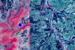
Laos is taking significant steps towards sustainable development by leveraging satellite remote sensing to evaluate carbon stocks across nine forest areas, covering 170,556 hectares. This initiative, led by the Ministry of Agriculture and Forestry, aims to establish a robust Carbon Credit Feasibility framework, with certification expected by the third quarter of 2025.
A recent Carbon Credit Feasibility Study Session in Vientiane brought together key stakeholders, including officials from the Agriculture and Forestry Department, Carbon Registry Thailand Co., Ltd. (CRT), and Carbon Credit Lao Co., Ltd. (CCL).
Associate Professor Dr. Thoumthone Vengvisouk, Deputy Director General of the Department of Forestry, emphasized the strategic importance of accurate carbon accounting enabled by advanced technology. “This initiative reinforces sustainable forest management while fostering local community engagement in conservation efforts,” he said.
Also Read – IBM and NASA Launch Prithvi-EO-2.0 for Advanced Geospatial Analytics
The project’s primary goal is to quantify carbon sequestration in forests, enabling Laos to tap into the global carbon market. This approach is expected to attract international investment, generate revenue, and support community development, biodiversity conservation, and improved forest management. Experts have highlighted that the designated forest areas have the potential to yield significant carbon credits, showcasing the country’s commitment to economic and environmental resilience.
The session also discussed expanding satellite remote sensing to agricultural sectors such as rubber plantations and orchards. This aligns with Laos’ broader Carbon Credit Feasibility goals by diversifying its credit portfolio and promoting sustainable agricultural practices. These efforts aim to enhance rural economies and contribute to the nation’s strategy to achieve carbon neutrality by 2050.
Dr. Thoumthone remarked, “Integrating advanced technologies in forestry and agriculture ensures sustainable resource management and provides economic opportunities for future generations.” With its focus on Carbon Credit Feasibility, Laos is positioning itself as a leader in sustainable development and global environmental stewardship.
Source: The Star


