NASA ARSET Training Announcement: Introduction to NASA Snow and Ice Data Products and Applications for Water Resources Management
The cryosphere—Earth’s frozen water on or beneath the surface—includes snow, glaciers, ice sheets, sea ice, and permafrost. It stores about 75% of the planet’s freshwater, mostly in glaciers and permafrost (USGS). Snowmelt is also a key water source in many regions. Snow and ice influence the planet’s temperature and energy balance by reflecting sunlight (albedo) and affect weather, ecosystems, transport, and infrastructure (NSIDC). Mountain snowpack can lead to avalanches or floods when it melts rapidly, while reduced snowpack can cause snow droughts.
NASA provides global and regional snow and ice data from satellites and Earth system models. These include snowfall analysis and snow water equivalent (SWE) estimates. An upcoming ARSET training, in collaboration with the National Snow and Ice Data Center and Western Water Applications Office, will introduce these tools, focusing on snow-fed river monitoring and water resource planning.
Training Objectives
By the end of this training series, participants will be able to:
- Explain why snow and SWE are critical for managing snow-fed river flows and water availability.
- Identify and use key NASA snow and ice products.
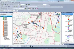
- Access and visualize NASA data using web tools.
- Apply satellite-derived snow data in regional water planning and disaster preparedness.
Audience & Prerequisites
Who should attend:
- Primary: Regional, state, and federal water managers; river network planners; disaster response teams; fish and wildlife managers.
- Secondary: Academics and students in water-related fields.
Prerequisite Knowledge: A foundation in remote sensing—such as ARSET’s self-paced “Fundamentals of Remote Sensing” course—is required .
Course Format & Dates
Format: Three 90-minute live webinars, each including 30 minutes of Q&A .
Sessions (All times EDT, UTC –4):
- Part 1 – July 24, 2025 (11:00–12:30 / 15:00–16:30)
Overview of snow & ice products, their characteristics, and applications in water resources and disaster monitoring. - Part 2 – July 31, 2025
Hands-on training: finding, analyzing, and visualizing NASA snow & ice datasets. Includes case examples like SnowEx, ASO, and MODIS. - Part 3 – August 7, 2025
A joint session with WWAO focusing on applying snow monitoring techniques in the Western U.S. Includes snowpack, albedo, melt timing, and forecasting water flow.
Registration & Certification
Registration: Two daily time slots available for each session:
- Session A: 11:00–12:30 EDT
- Session B: 15:00–16:30 EDT
Completion: Attend all three sessions and participate in Q&A to receive a certificate of attendance .
How to Register
- Visit the ARSET training page (search “ARSET Introduction to NASA Snow and Ice Data Products”).
- Choose either Session A or B for each date.
- Sign up via NASA’s Applied Sciences portal.
- Be sure to complete the “Fundamentals of Remote Sensing” course beforehand.