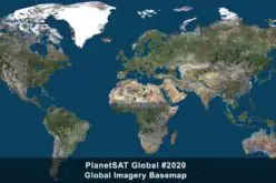
PlanetObserver is excited to announce the release of PlanetSAT Global 2022, a basemap that provides ready-to-perform, cloudless,and homogeneous imagery.
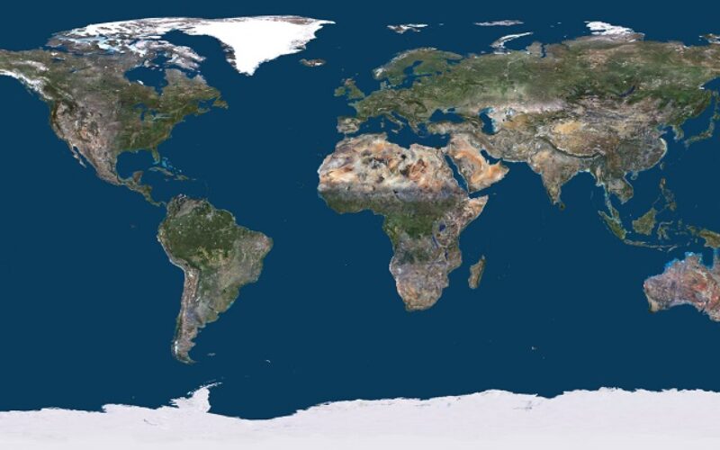
Detailed and up-to-date global basemap
With outstanding 10-meter resolution, PlanetSAT Global imagery basemap provides access to detailed geographic information from global scales all the way down to 1:50,000 map scale.
One major feature of PlanetSAT basemap is the updates that we release on an annual basis.We understand that outdated imagery is often of little or no use for many projects and solutions. Indeed, annual updates ensure that users can access the most current image layer available.
For PlanetSAT Global 2022, more than 10 Million km² of fresh 10-meter imagery have been ingested in the global basemap. The main updated areas include the United States and the United Arab Emirates. In addition, over 170 major cities worldwide have been updated.
The refreshed imagery content continues to grow. PlanetObserver has indeed committed to an impressive annual update schedule. This makes this global imagery solution more robust every year, having analyzed and processed more than 204.4 trillion pixels of data since 2003.
Earth is beautiful
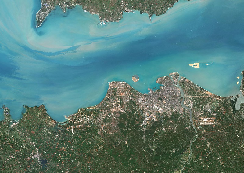
Planet Earth is incredibly gorgeous because of the difference of its thousands of ecosystems and its diversity throughout the whole planet. All of us knew that forests, deserts, and oceans all had different colors. However, not many know how the earth looks from space.
Do the colors look similar? The answer is no. The color perspective from raw satellite imagery is not reliable, everything looks darker and unrealistic. This is an effect caused by the atmosphere and the color receptors of the satellite that is capturing the images.
PlanetObserver processes the images in a way that everyone can understand the geographical context of the terrain through realistic and natural colors. So where do these colors come from? They are the results of hours of graphics processing by our experts, which lead to these beautiful colors that we perceive!
For over 20 years, PlanetObserver has produced global imagery mosaics, gaining the necessary skills to select highly informative data, and process them into the most visually stunning basemaps.
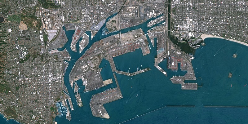
Cloudless imagery
Selecting the proper satellite imagery to create a mosaic is very challenging. More than 70% of Earth is constantly covered with clouds throughout the year. Consequently, we take advantage of the different seasons to get the best possible cloudless imagery for each area.
Recently, satellite imagery providers have released “completely cloudless” basemaps. However, this is not achievable for tropical areas in South-East Asia, Africa and South America that are covered by clouds 99% of the time. One common approach is to change the colors of cloudy areas for the map to look homogeneous even though the real geographic data is not accessible. However, this damages the data and gives the user a false overview of the desired area.
Our strategy is to remove clouds from the basemap at each annual update by selecting 100% cloud-free source imagery. However, for all tropical areas, we keep the real pixels, even though clouds might still be present. Our commitment is to provide real and reliable geographic information!
Free-to-use viewer
For the first time, PlanetObserver is integrating a free-to-use viewer at planetobserver.com. Previously, only our clients could access the basemap. This year, we have decided to make our data more visible to the world and give everyone a taste of how satellite imagery is supposed to look like.
We see the viewer as an essential tool since it allows for everyone to have access to our newest data. The viewer includes PlanetSAT Global 2022 basemap in which you will be able to check out any corner on Earth!
If you want to give it a try or look for a place your curious about, just go try it at Planetobserver.
Also, read – PlanetDEM – A Highly Reliable Digital Elevation Model
Global context for mapping and visualization
Thanks to advanced imagery mosaic techniques, including color balancing and seamless blending of thousands of single imagery scenes, PlanetSAT Global product provides a visually consistent and continuous imagery layer over the whole world.
The global basemap is therefore best adapted to support mapping and visualization. It gives global context to many professional applications, from modeling and simulation solutions to GIS tools and web mapping platforms.
Moreover, customers get access to a ready-to-integrate global imagery basemap, available off-the-shelf in many professional formats, ranging from GeoTIFF, JPEG 2000, COG to ECW. It is also available in global, continental, country or custom AOI coverage.
Do you have the need for regularly updated images of locations around the world?
Perhaps you need imagery to integrate with an OEM solution you are developing?
Let’s talk! For more information, please contact us by filling our contact form.
About PlanetObserver
Based in France and established in 1989, PlanetObserver is specialized in the processing and production of high value-added geospatial data. The company develops innovative products that maximize the visual and technological performances of all clients’ projects and solutions in the Defense, Aerospace, Mapping and GIS sectors. With a constant commitment to R&D and innovation, PlanetObserver is positioned as the supplier and partner of leading companies located in Europe, North America and Asia-Pacific.
Contact:
PlanetObserver – 25 bd Gergovia – 63000 Clermont-Ferrand – France
Phone: (+33) 04 73 44 19 00 – info@planetobserver.com
www.planetobserver.com