New Version of Trimble Access Enables Broader Accessibility to Android OS for Surveyors
Trimble TDC600 Android Device and Trimble Access 2020 Software Provide More Flexibility for a Diverse, Mobile Workforce.
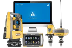
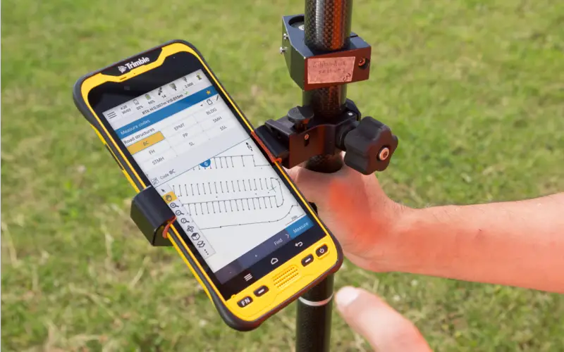
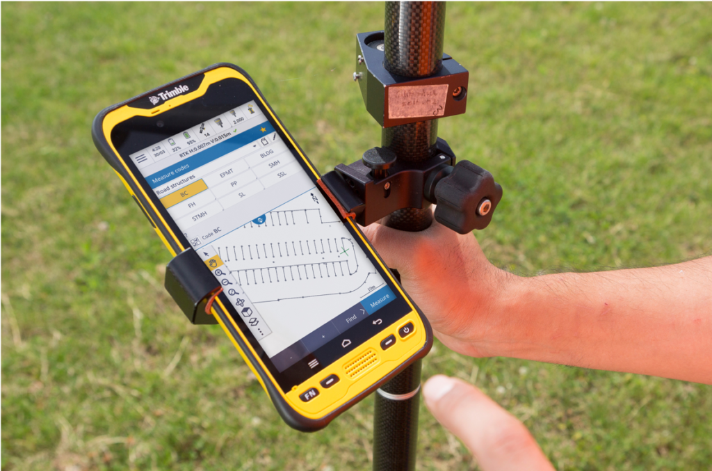
SUNNYVALE, Calif., May 7, 2020—Trimble (NASDAQ: TRMB) has announced that its Trimble Access™ 2020 field software is now available on the Trimble® TDC600 rugged mobile device powered by Android. This combination offers surveyors the ability to leverage their familiar workflows and survey instruments while using an Android OS platform.
Accessible to More Surveyors with Android OS
For surveyors looking to use a smart-phone style mobile device to collect data in the field, the Trimble TDC600 running Trimble Access 2020 provides an optimal solution with its lightweight, rugged design. It is also ideal for surveyors looking for a lower-cost platform with the new Trimble Access software and workflows.
“The ability to use the intuitive field software on the Trimble TDC600 Android device will put Trimble Access in the hands of more surveyors and engineers,” said Jason Rossback, marketing director for Trimble Geospatial Field Solutions. “This solution provides a powerful option for field workers such as road inspectors, who need the full set of survey tools combined with the portability of a mobile device.”
New Version of Trimble Access Enables Broader Accessibility to Android OS for Surveyors
Availability
Trimble’s TDC600 Android device and Trimble Access 2020 are both available now through Trimble’s authorized Geospatial Distribution Network. Customers using Trimble Access on Windows 10 devices, such as the Trimble TSC7 and Trimble T10 tablet, can also upgrade to Trimble Access 2020 for Windows to take advantage of additional tools and workflows in the new version, including independent measurements with GNSS constellations and additional user-interface enhancements. For more information, visit: Trimble Access.
About Trimble Geospatial
Trimble Geospatial provides solutions that facilitate high-quality, productive workflows and information exchange, driving value for a global and diverse customer base of surveyors, engineering and GIS service companies, governments, utilities and transportation authorities. Trimble’s innovative technologies include integrated sensors, field applications, real-time communications and office software for processing, modeling and data analytics. Using Trimble solutions, organizations can capture the most accurate spatial data and transform it into intelligence to deliver increased productivity and improved decision-making. Whether enabling more efficient use of natural resources or enhancing the performance and lifecycle of civil infrastructure, timely and reliable geospatial information is at the core of Trimble’s solutions to transform the way work is done. For more information, visit: https://geospatial.trimble.com.
About Trimble
Trimble is transforming the way the world works by delivering products and services that connect the physical and digital worlds. Core technologies in positioning, modeling, connectivity and data analytics enable customers to improve productivity, quality, safety and sustainability. From purpose built products to enterprise lifecycle solutions, Trimble software, hardware and services are transforming industries such as agriculture, construction, geospatial and transportation. For more information about Trimble (NASDAQ:TRMB), visit: www.trimble.com.
Media Contact:
Lea Ann McNabb
+1 408-481-7808
leaann_mcnabb@trimble.com