
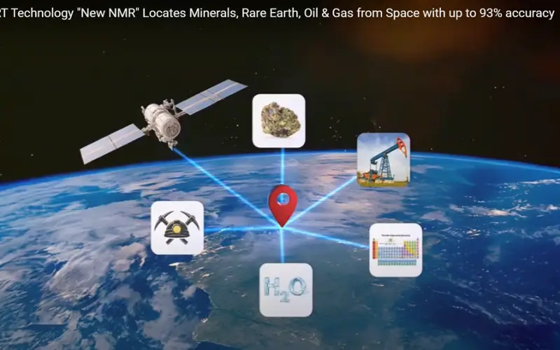
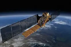
A major milestone has been reached in the field of remote sensing mineral detection with the public disclosure of a once-private technology. CC Explorations, a trailblazer in mineral remote sensing, has introduced its innovative use of Atomic Mineral Resonance Tomography (AMRT) Technology via satellites to identify mineral deposits both on land and underwater. This advanced technique mirrors the methods NASA uses to detect minerals on distant planets.
This innovation uses satellite-based remote sensing to map mineral-rich regions without the need for extensive field surveys. By analyzing spectral data from space, the system identifies unique mineral signatures across large and remote areas, opening new opportunities for efficient resource exploration.
Transforming Mineral Exploration Through Space-Based Sensing
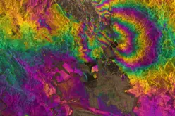
The technology operates by capturing data across various electromagnetic bands—visible, near-infrared, and shortwave infrared. These bands reflect the composition of surface materials, enabling the identification of minerals based on their spectral properties. This non-invasive method enhances the speed and safety of exploration, particularly in hard-to-reach or ecologically sensitive locations.
Also Read – Heli-Borne Geophysical Survey Aims to Unlock Mineral Wealth
The release of this remote sensing mineral detection system to the public is a game-changer. It empowers exploration companies and government agencies with high-accuracy data before any ground activity begins, reducing operational costs and minimizing environmental impact.
Practical Impact Across Industries
The method is already being used by several industries, including mining and geology, to improve early-stage exploration. It allows users to pinpoint potential hotspots for minerals by integrating satellite imagery with Geographic Information Systems (GIS). This integration improves decision-making and accelerates the planning process for field operations.
With more than 150 high-resolution satellite datasets available, including both commercial and open-source imagery, users can apply remote sensing mineral detection on a global scale. Historical satellite records also make it possible to track changes in land surface characteristics over time, enhancing both exploration and monitoring capabilities.
Promoting Global Accessibility and Research
The decision to publicly disclose this technology supports global collaboration. Research institutions, environmental planners, and developing countries can now access advanced tools for responsible mineral exploration. The broader availability of remote sensing mineral detection methods encourages more data-driven decisions in land management and sustainability planning.
Conclusion
The public release of remote sensing mineral detection technology marks a turning point in the way we approach resource exploration. By combining advanced satellite imagery with spectral analysis, this innovation is set to redefine how we find and manage Earth’s hidden resources.
Source: CC Explorations, LLC


It would be really interesting to know if there are already any available APIs or functional web platforms that allow professionals, institutions, or researchers to directly access this global dataset—especially the 150+ satellite datasets mentioned. Being able to integrate this information into GIS environments or automated analysis workflows (e.g., using Python or QGIS) would make a real difference in terms of usability, interoperability, and scalability
Using satellite remote sensing to detect minerals is accurate, efficient, and reduces environmental impact. It is the future of mining exploration! Combining GIS and multispectral data will make global resource exploration smarter, benefiting both research institutions and companies. Look forward to more innovations like this!