Radar Satellite Data for Mapping Dynamics of Deforestation and Forest Degradation
Have you ever think about the importance of forests in our daily lives of concrete jungles?
Forests products are used in our daily lives. All activities directly or indirectly involve forests. They are habitats to diverse animal species, and also form the source of livelihood for many different human settlements. Yet we are losing them.
In a study by Neha Joshi et. al. “Mapping dynamics of deforestation and forest degradation in tropical forests using radar satellite data”
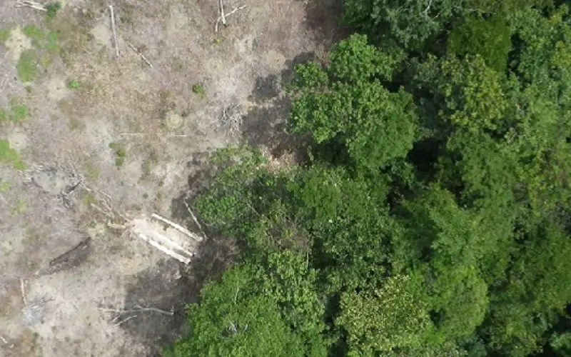
Of particular interest to forest monitoring is detecting degradation, i.e. the anthropogenic reduction of forest cover or woody biomass in areas that still remain defined as ‘forests’ of more than 10–30% tree cover (FAO 2002). In contrast to deforestation, which can be identified based on classifications of forest into changed/unchanged, degraded forests can be in any state along a ‘bare-ground’ to ‘intact-forest’ continuum based on numerous definitions (Schoene et al 2007, Sasaki and Putz 2009, Guariguata et al 2009).

Anthropogenic activity mapping are largely been focused on delineation of deforestation using optical remote sensing. But certain areas of earth such as tropical forest which are frequently cloud cover, optical remote sensing technique could not see through the clouds and the problem of quantifying forest degradation remain a challenge for scientific community.
In this study, researcher used long-wavelength Radar (L-band from ALOS PALSAR) backscatter to detect processes of deforestation, forest degradation and successional dynamics. Researchers develop an algorithm to detection and that allows for repeated disturbances on the same land, and identifies areas with slow- and fast-recovering changes in backscatter in close spatial and temporal proximity.
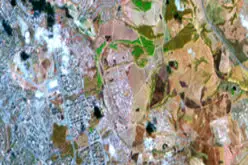
The study area covers parts of Tahuamanu and Tambopata provinces of Madre de Dios. Natural ecosystems of tropical forests cover 80% of the area, including lowland rainforests and extensive thickets of arborescent bamboo on alluvial terraces and floodplains. Other natural ecosystems cover less than 5% of the region, including palm swamps (3%) and rivers (2%).
Soil moisture plays an important role in Radar remote sensing. Depending upon the moisture content of the soil, Radar backscatter can vary and decrease its contrast over forest and bare ground. To play down the problem, researchers used two dry season scenes which were acquired from the phased array L-band Synthetic Aperture Radar sensor aboard the Advanced Land Observing Satellite (ALOS PALSAR) in July–August for each year from 2007 to 2010.

After that acquired images were terrain corrected and radiometrically calibrated using 3 arc second SRTM (Shuttle Radar Topography Mission) dataset. Then Radar images were despeckled using the Enhanced Lee Filter.
To reduce any remaining variability in backscatter unrelated to anthropogenic disturbances, images were calibrated to the base year (2007) by adjusting pixel values by the difference in average backscatter over a 510 × 510 m window. This procedure was chosen since it showed reasonable adjustment over known forest/non-forest areas (collected field data described in section 3.2.2), and corrected for variations over different land cover types locally.
Detection Algorithm:
A preliminary investigation of the study region revealed frequently disturbed areas with a continuum of surrounding disturbed land. To maximize the detection of these areas, researcher exploited the advantage of multi-temporal and spatially continuous radar images. A time-series allows the same pixel to be observed multiple times, and hence allows more confidence in determining its status (disturbed/undisturbed), as compared to only two observations. To minimize detecting backscatter variations unrelated to anthropogenic disturbances, used a local moving-window filtering procedure that assumes that disturbances are more likely to be real if they neighbour other disturbances.
The designed algorithm hence:
- uses multi-temporal data as intermediate information to verify disturbance locations, but does not temporally categorize change pixels initially, and
- identifies areas with slow-recovering and fast-recovering backscatter change in close proximity, but does not spatially categorize these into deforested/degraded.
Results and Discussions:
The magnitude of initial radar backscatter, and backscatter decrease, suggested that large-scale deforestation was likely in areas with initially low biomass, either naturally or since already under anthropogenic use. Further, backscatter increases following disturbance suggested that radar can be used to characterize successional disturbance dynamics, such as biomass accumulation in lands post-abandonment.
The presented radar-based detection algorithm is spatially and temporally scalable, and can support monitoring degradation and deforestation in tropical rainforests with the use of products from ALOS-2 and the future SAOCOM and BIOMASS missions.