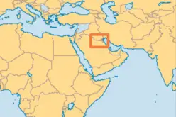
The United States and Bahrain have embarked on a transformative partnership with the launch of the Geospatial Acceleration Initiative under the Comprehensive Security Integration and Prosperity Agreement (C-SIPA). This initiative aims to enhance regional security and military coordination through the development of cutting-edge geospatial datasets.
Strengthening Strategic Capabilities
The collaboration focuses on creating advanced hydrographic, aeronautical, and topographic data. These datasets are critical for improving military navigation, ensuring maritime security, and supporting regional operations. Such capabilities bolster Bahrain’s role as a strategic partner in the Gulf region while reinforcing US-Bahrain ties.
Geospatial Technologies in Security
Geospatial data plays a pivotal role in addressing complex security challenges. The initiative integrates modern technologies to enable accurate mapping and data analysis. These tools not only improve situational awareness for defense operations but also streamline decision-making processes during crises.
Also Read – India-US Geospatial Alliance Boosts Trade Prospects
Regional and Global Impact
This partnership is expected to enhance Bahrain’s ability to tackle regional threats, including maritime piracy and territorial disputes. It also serves as a model for how geospatial technologies can be employed to maintain stability in volatile regions, contributing to global peacekeeping efforts.
A Testament to Longstanding Relations
The initiative underlines the enduring relationship between the US and Bahrain, highlighting their commitment to mutual security and prosperity. By working together on high-tech solutions, the nations are paving the way for future innovations in defense and regional cooperation.
The Geospatial Acceleration Initiative showcases the transformative potential of technology in safeguarding nations and fostering international alliances. Its successful implementation is expected to set a benchmark for similar partnerships worldwide.
Source: News of Bahrain


