 6 January 2015 — The W3C and the Open Geospatial Consortium (OGC) announced today a new collaboration to improve interoperability and integration of spatial data on the Web. Spatial data —describing geographic locations on the earth and natural and constructed features— enriches location-based consumer services, online maps, journalism, scientific research, government administration, the Internet of Things, and many other applications. In the United States alone, geospatial data and services are estimated
“Location, as well as providing context to much of today’s online information, is vital to the emerging field of connected devices,” said Ed Parsons, Geospatial Technologist at Google. “Through this collaboration we hope to make the understanding of geospatial knowledge a fundamental component of the Web.”
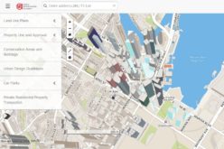
Spatial data is integral to many of our human endeavors and so there is a high value in making it easier to integrate that data into Web based datasets and services. For example, one can use a GIS system to find “the nearest restaurant” but today it is difficult to associate that restaurant with reviewer comments available on the Web in a scalable way. Likewise, concepts used widely on the Web such as “the United Kingdom” do not match the geographic concepts defined in a GIS system, meaning Web developers are missing out on valuable information available in GIS systems. Bridging GIS systems and the Web will create a network effect that enriches both worlds.
“Location plays a vital role for BBC Online, not least in our remit to provide timely information for Weather, Travel and Local News,” said Chris Henden, Service Owner for Location Services at BBC Future Media. “It matters across the service, from maps showing places of note in World War One, to detailed context for breaking news. We source data from various third parties, then transform, curate, and make it available to our front-end services. There is a perceptible gap between the specialised world of geographic data, and that of the Web. Bridging that gap can take significant, repeated effort, and is not always successful or possible. Therefore this collaboration between the OGC and W3C is more than welcome.”
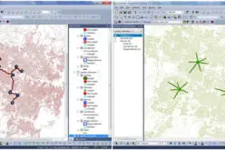
More than 100 participants discussed these challenges at the March 2014 Workshop on Linking Geospatial Data, co-organized by OGC and W3C in partnership with the UK Government Linked Data Working Group, Google, and Ordnance Survey (the UK mapping agency). Stories ranging from management of data in response to the Fukushima nuclear plant accident to the use of spatial data to create new services from spatial and historical data in the Netherlands illustrated a diverse set of integration benefits and challenges.
Informed by the conclusions from that Workshop, the collaboration announced today will enable publishers of spatial data, providers of services that consume the data, and application developers to establish common practices and reduce the cost of integrating spatial data on the Web. Through the collaboration the Geospatial and Web communities will document use cases and requirements, develop best practices for publishing spatial data on the Web, and advance some existing technologies to W3C Recommendations and OGC standards.
“Through this collaboration we will ensure that governments and research labs will have a way to open up their spatial data to be used transparently by scientists, industry, and citizens alike,” said Dr Kerry Taylor, Principal Research Scientist at Australia’s CSIRO.
Richard Carne, Chief Digital Officer at the MetOffice added, “With growing demand for weather data services delivered via the Web, this joint effort will ensure the progress of practical and usable standards for the integration and communication of location related data.”
Participants will evaluate the use of Linked Data for managing the complex evolution and integration of spatial data. The Linked Data approach enables people to produce data independently, and to then easily integrate heterogeneous data from diverse sources.
“We have used Linked Data — including early work on W3C’s Semantic Sensor Network ontology and OGC’s GeoSPARQL — to monitor and manage ground water levels affecting vulnerable underground archaeological sites,” said Linda van den Brink of Geonovum, the Dutch government geospatial standards body. “We demonstrated that when you have a way to easily express location in Linked Data, you can combine geo-information with other data and discover new information without much effort.”
For this collaboration, W3C and OGC have each launched a Spatial data on the Web Working Group. See http://www.w3.org/2015/spatial/ and http://www.opengeospatial.org/projects/groups/sdwwg. The groups, both chaired by Ed Parsons and Kerry Taylor, will coordinate closely and publish deliverables jointly. For W3C, this work is supported in part by the SmartOpenData project.
About the Open Geospatial Consortium
The OGC® is an international geospatial standards consortium of more than 500 companies, government agencies, research organizations, and universities participating in a consensus process to develop publicly available standards. OGC standards support interoperable solutions that “geo-enable” the Web, wireless and location-based services, and mainstream IT. Visit the OGC website at http://www.opengeospatial.org/.
About the World Wide Web Consortium
The World Wide Web Consortium (W3C) is an international consortium where Member organizations, a full-time staff, and the public work together to develop Web standards. W3C primarily pursues its mission through the creation of Web standards and guidelines designed to ensure long-term growth for the Web. The Open Web Platform is a current major focus. Over 400 organizations are Members of the Consortium. W3C is jointly run by the MIT Computer Science and Artificial Intelligence Laboratory (MIT CSAIL) in the USA, the European Research Consortium for Informatics and Mathematics (ERCIM) headquartered in France, Keio University in Japan, and Beihang University in China, and has additional Offices worldwide. For more information seehttp://www.w3.org/