PlanetObserver is excited to announce the release of PlanetSAT Global 2023, a basemap that provides ready-to-perform, cloudless, and homogeneous imagery.
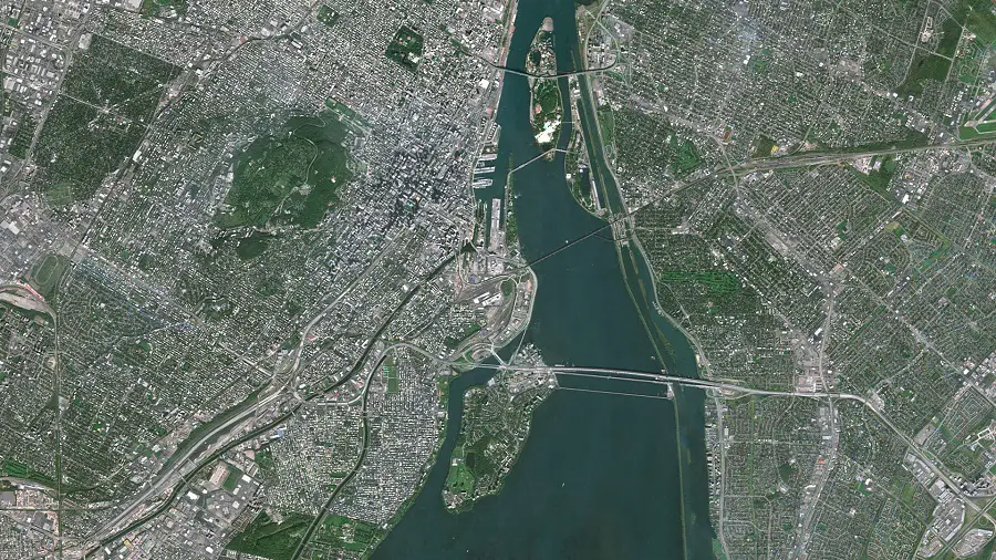
PlanetSAT Global now has a refined 10m zoom level
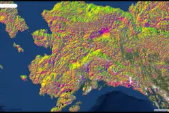
PlanetObserver has done major improvements to their latest basemap for 2023. Designed to offer a more comprehensive understanding of our planet’s terrain and geography, PlanetSAT Global 2023 now provides exceptional clarity and sharpness, capturing every nuance of the Earth’s diverse landscape.
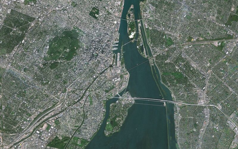
With realistic and natural colors, PlanetSAT Global 2023 offers an unprecedented level of detail, allowing users to zoom in and explore different geographical features with ease, from cityscapes to natural areas and industrial sites. By providing a better geographic context with every pixel. PlanetObserver aims to give users a deeper understanding of the Earth’s surface and its various features, ultimately improving the user experience.
PlanetSAT Global 2023 is the perfect tool for anyone seeking accurate and precise satellite imagery of the Earth’s surface. With its unparalleled level of detail and improved visual clarity, it will undoubtedly become an essential resource for professionals in various industries, including mapping, GIS, modelling and simulation and broadcasting.
Detailed and up-to-date global basemap
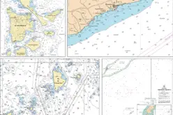
With outstanding 10-meter resolution, PlanetSAT Global imagery basemap provides access to detailed geographic information from global scales all the way down to 1:50,000 map scale.
In addition, PlanetObserver is committed to annual updates to ensure that users can access the most current image layer available. The refreshed imagery content continues to grow, with the company having analyzed and processed more than 235 trillion pixels of data since 2003. This makes PlanetSAT Global more robust every year, ensuring that users have access to the most accurate and up-to-date information.
Cloudless imagery
At PlanetObserver, we understand the importance of providing our clients with high-quality basemaps that accurately reflect the geographic landscape. To achieve this, we have developed a unique approach that takes advantage of seasonal changes to obtain the best possible cloud-free imagery for each area.
It’s worth noting that while some satellite imagery providers offer “completely cloudless” basemaps, it’s not achievable in regions such as South-East Asia, Africa, and South America, where clouds cover up to 99% of the area. That’s why we have developed a strategy that enables us to deliver real and reliable geographic information.
One common approach to creating basemaps in areas with prevalent cloud cover is to change the colors of cloudy areas to achieve a homogeneous appearance. However, this practice comes at a cost. It damages the data, leading to a distorted view of the desired area.
At PlanetObserver, we are committed to providing authentic and reliable geographic information to our clients. To achieve this, we remove clouds from the basemap at each annual update by selecting 100% cloud-free source imagery. In challenging tropical spots where clouds are still present, we opt to retain the real pixels and not alter their color.
Our unique approach enables us to deliver high-quality basemaps that meet the needs of our clients, even in regions with challenging cloud cover. We understand the importance of providing accurate and up-to-date geographic data to our clients, and our commitment to delivering real and reliable information is at the core of everything we do.
Free-to-use viewer
PlanetObserver integrates a free-to-use viewer at planetobserver.com. Previously, only our clients could access the basemap. This year, by including PlanetSAT Global 2023 the highest zoom level of the map will be very clear.
If you want to give it a try or look for a place you are curious about, just go try it here.
Global context for mapping and visualization
PlanetSAT Global 2023, provides a visually consistent and continuous imagery layer over the entire world. Through color balancing and seamless blending of thousands of single imagery scenes, PlanetSAT Global delivers a global basemap that is best adapted to support mapping and visualization. It offers global context to many professional applications, from modeling and simulation solutions to GIS tools and web mapping platforms.
At PlanetObserver, we understand the importance of providing our clients with high-quality basemaps that are ready to integrate into their projects. That’s why we offer our customers access to a ready-to-integrate global imagery basemap, available off-the-shelf in many professional formats, ranging from GeoTIFF, JPEG 2000, COG to ECW. This makes it easier for our clients to integrate our basemap into their workflows.
Our PlanetSAT Global product is available in global, continental, country, or custom AOI coverage, providing flexibility and adaptability to meet the needs of our clients. Whether you need global context or require more specific coverage, our product has got you covered.
About PlanetObserver
Based in France and established in 1989, PlanetObserver is specialized in the processing and production of high-value-added geospatial data. The company develops innovative products that maximize the visual and technological performances of all clients’ projects and solutions in the Defense, Aerospace, Mapping, and GIS sectors. With a constant commitment to R&D and innovation, PlanetObserver is positioned as the supplier and partner of leading companies located in Europe, North America, and Asia-Pacific.
Learn more about PlanetSAT Global 2023