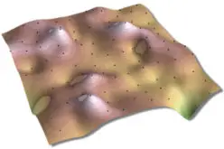
GIS stands for Geographic Information System.
Introduction
This portion provides an overview of GIS. It examines what GIS is, what it can do and, in brief, how it works. One of the best ways to introduce GIS is to consider the generic types of questions they have been designed to answer. These include questions about location, patterns, trends and conditions:
- Where are particular features found?
- What geographical patterns exist?
- Where have changes occurred over a given time period?
- Where do certain conditions apply?
- What will the spatial implications be if an organization takes certain action?
Defining GIS
Definition of GIS will depend on who is giving it, and their background and viewpoint. Based on technology and applications develop, GIS definition varies. Some of the shorter definitions give an idea about GIS. For example, Rhind (1989) proposes that `GIS is a computer system that can hold and use data describing places on the earth’s surface’. Fuller definitions give more idea of what GIS can do, as well as what they are. Those provided by Burrough (1986): `a set of tools for collecting, storing, retrieving, transforming, and displaying spatial data from the real world for a particular set of purposes’.
In general, the definitions of GIS cover three main components. They reveal that GIS is a computer system. This implies more than just a series of computer boxes sitting on a desk, but includes hardware, software and appropriate procedures. They also tell us that GIS uses spatially referenced or geographically data, and that GIS carries out various management and analysis task on these data.
Components of GIS: GIS can be divided in to five basic components. They are:
1. Hardware:
- Processor with sufficient power to run software.
- Sufficient memory for storage and processing of large volume of data.
- Good quality and high resolution color graphic screen.
- Data input and output devices.
2. Software:
- Operating System.
- A set of application Software modules.
3. Data:
- Data is the essential components of GIS. The data consists of Spatial, Non-spatial and Meta data.
4. Live-ware or Brain-ware:
- Trained personnel or skilled persons.
5. Procedures or methods.
Why we need GIS?
Now a days GIS is extensively used every where because of the following reasons:
1. Retrieval and analysis of map data by visual inspection is very difficult when large volume of data are involved but in GIS it is possible, hence maximize the efficiency of planning and decision making.
2. Complex analysis/query involving geographically referenced data to generate new information.
3. Capacity to integrate information from many sources and provide efficient means of data distribution and handling.
4. Elimination of redundant database (minimize duplication) and attaching attribute and thematic information to geographic features.
Application of GIS:
- Location: What exists at a particular location?
- Condition: Identify locations where certain conditions exists?
- Trends: What has changed since?
- Patterns: What spatial patterns exists?
- Modeling: What if —- happens ?


