Precise Terrain Information Globally for Effective Analysis
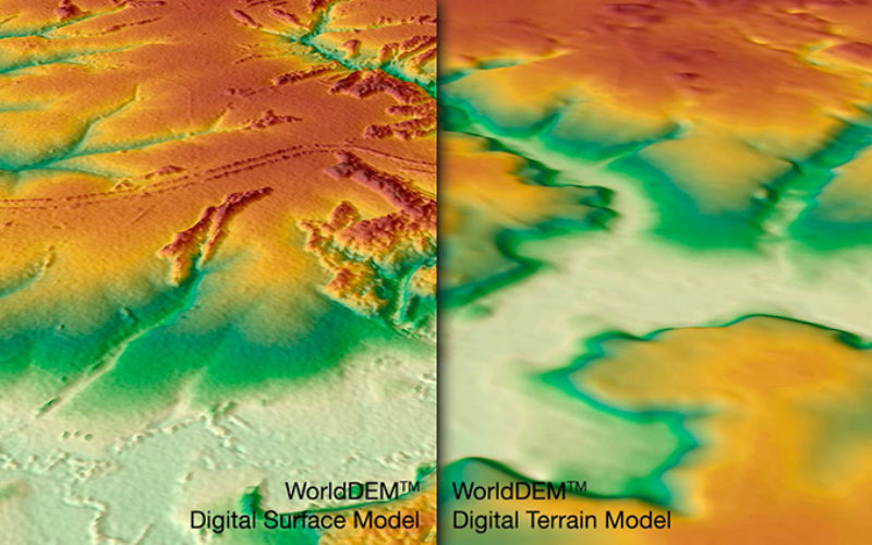
The WorldDEM Digital Terrain Model (DTM) is now commercially available for all users that need superior terrain information anywhere on the globe. The WorldDEM DTM is derived from the WorldDEM™ Digital Surface Model (DSM) product by removing vegetation and man-made objects to show the bare terrain of the Earth’s surface.
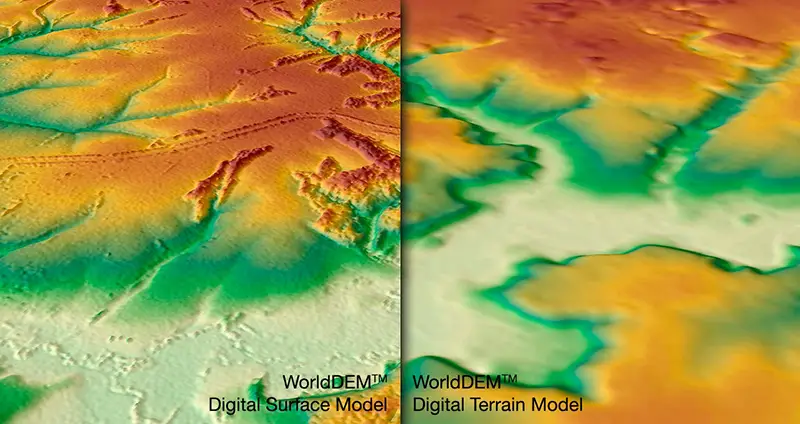
This high-quality WorldDEM DTM provides an excellent foundation layer for applications such as civil engineering (e.g. road design, Earth work calculation), the management of natural resources as well as planning and implementation of military operations (e.g. vehicle trafficability analysis, 3D terrain visualisation).
WorldDEM DTM in Brief
- Superior terrain information anywhere on Earth
- Can be delivered based on the high-resolution WorldDEM™ for any point on the globe
- Unrivalled accuracy: 5m (relative) / 10m (absolute) vertical accuracy in a 12m x 12m raster
- Easy access and fast delivery
Test Data available here
More about WorldDEM : http://www.geo-airbusds.com/