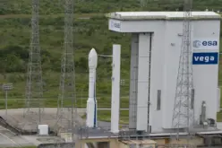

In a significant stride for India’s space capabilities, the Indian Space Research Organisation (ISRO) successfully launched the Earth Observation Satellite EOS-08 on August 16, 2024. The mission, executed via the Small Satellite Launch Vehicle (SSLV-D3), emphasizes advanced satellite technology, incorporating state-of-the-art systems and payloads designed to serve multiple critical applications.
EOS -08 Mission Overview
- Launch Vehicle: SSLV-D3, a reliable and cost-efficient launch vehicle designed for rapid deployment of small satellites.
- Orbit Details: The satellite was successfully placed in a Circular Low Earth Orbit (LEO) at an altitude of 475 km and an inclination of 37.4°, ideal for Earth observation tasks.
- Mission Duration: EOS-08 is expected to operate for a full year, providing valuable data for various applications.
- Satellite Specifications:
- Mass: 175.5 kg
- Power: Generates approximately 420 W, supported by innovative flexible solar panels.
Objectives of EOS-08 Mission
- Microsatellite Development: The mission focused on designing and creating a microsatellite equipped with advanced payloads and systems.
- Integration of New Technologies: The satellite serves as a platform for testing cutting-edge technologies aimed at future operational satellites.
- Payload Testing: It aimed to validate payload instruments compatible with the microsatellite bus.
Similar Read – Launch of Bhuvan Panchayat (v4.0) & National Database for Emergency Management (v5.0)
EOS-08 Mission Payloads
- Electro-Optical Infrared Payload (EOIR):
- Expertise: Designed for capturing high-resolution images in both Mid-Wave IR (MIR) and Long-Wave IR (LWIR) bands.
- Applications:
- Surveillance: Supports satellite-based monitoring and reconnaissance.
- Disaster Management: Facilitates real-time monitoring of natural disasters such as wildfires and volcanic eruptions.
- Environmental Monitoring: Provides data crucial for tracking environmental changes and industrial activities.
- Global Navigation Satellite System-Reflectometry (GNSS-R) Payload:
- Authoritativeness: Demonstrates the capability of GNSS-based remote sensing.
- Applications:
- Oceanographic Studies: Enables detailed analysis of ocean surface winds.
- Soil Moisture & Cryosphere Research: Critical for agriculture and climate studies, especially over the Himalayan region.
- Silicon Carbide (SiC) UV Dosimeter:
- Experience: Specifically developed for the Gaganyaan Mission, it monitors UV radiation levels.
- Applications: Acts as a high-dose alarm sensor for gamma radiation, crucial for the safety of astronauts.

EOS-08 satellite
Image Credit: ISRO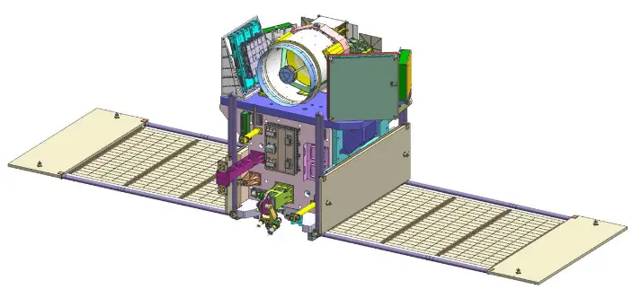
EOS-08 satellite
Image Credit: ISRO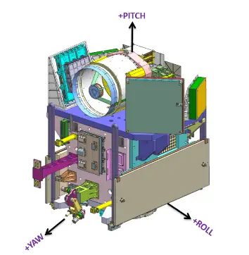
EOS-08 satellite
Image Credit: ISRO
Technological Innovations
- Integrated Avionics System: The mission introduced the Communication, Baseband, Storage, and Positioning (CBSP) Package, a multi-functional unit with 400 GB of data storage, showcasing ISRO’s expertise in satellite system integration.
- Miniaturized Antenna Systems: The phased array antenna and Antenna Pointing Mechanisms enhance communication and ensure precise satellite orientation, vital for data accuracy and reliability.
- Thermal Management and Power Systems: Advanced materials such as pyrolytic graphite ensure efficient thermal management, while flexible solar panels improve power generation and structural integrity, reflecting ISRO’s commitment to using cutting-edge technology in space missions.
Applications and Impact
The EOS-08 mission is poised to deliver substantial benefits across sectors like disaster management, environmental monitoring, and scientific research. Its payloads will provide invaluable data, aiding in better resource management and contributing to critical studies on climate change and natural disaster preparedness.
ISRO’s successful execution of the EOS-08 mission underscores India’s growing expertise in space technology and its commitment to developing innovative solutions for global challenges.
Source: ISRO