Offshore energy operations, from oil drilling to wind farms, rely on precise planning, coordination, and safety measures. Unlike land-based projects, offshore facilities must contend with unpredictable weather, strong ocean currents, and remote locations, making geolocation technology essential. Whether it’s positioning a drilling rig, guiding supply vessels, or ensuring the stability of offshore wind turbines, accurate location data plays a vital role. Without it, operations could face costly delays, safety risks, and inefficiencies. As offshore energy continues to expand, geolocation tools are becoming even more advanced, helping companies improve efficiency, reduce risks, and maintain seamless operations in challenging environments.
Positioning Offshore Energy Infrastructure
Setting up offshore energy projects is a complex task that requires pinpoint accuracy. Oil platforms and wind farms must be placed in optimal locations, not only to maximise energy production but also to withstand environmental pressures. Engineers use geospatial data to analyse the seabed, ensuring that structures are placed on stable ground. Floating wind turbines, which are becoming more common, require constant location monitoring to stay anchored correctly. Without precise geolocation data, misplacements can lead to structural damage or inefficiencies, making real-time tracking essential for offshore energy development.
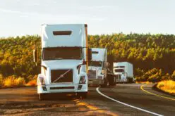
Fleet Tracking for Supply and Maintenance Vessels
Offshore energy projects depend on a fleet of vessels to transport workers, equipment, and supplies. Managing these movements efficiently is crucial, as delays can be costly. Using fleet tracking, companies can monitor vessel locations, ensuring that supply chains remain uninterrupted. This technology helps ships avoid congestion, take the safest routes, and optimise fuel consumption. It also plays a role in emergency response, allowing teams to quickly locate and assist vessels in distress. By integrating fleet tracking into offshore logistics, energy companies can streamline operations and improve overall safety at sea.
Enhancing Worker Safety in Remote Locations
Working on an offshore energy site comes with risks, from rough seas to extreme weather conditions. To keep workers safe, companies use geolocation tools to track personnel and ensure that emergency protocols can be activated quickly when needed. Real-time tracking allows rescue teams to respond immediately to incidents such as equipment malfunctions or accidents. Helicopters transporting workers to and from platforms also rely on geolocation to navigate changing weather conditions. The ability to monitor movement in real time makes offshore energy operations far safer, reducing the risk of workers being stranded in remote areas.
Monitoring Environmental Impact
Offshore energy operations must comply with strict environmental regulations to protect marine ecosystems. Geospatial technology helps track underwater drilling activities, preventing damage to coral reefs or marine life. In wind energy projects, geolocation is used to study bird migration patterns and ensure that turbines are placed in areas with minimal impact on wildlife. By continuously monitoring environmental data, energy companies can adjust their operations to reduce their ecological footprint. This not only helps them comply with regulations but also promotes sustainable energy practices in offshore settings.
The Future of Geolocation in Offshore Energy
As offshore energy production expands, geolocation technology is evolving to meet new challenges. Advanced satellite systems, AI-powered analytics, and autonomous monitoring tools are making offshore operations more precise and efficient. Future developments may include self-adjusting floating wind turbines that use real-time geolocation data to optimise positioning. Drones and underwater robots equipped with geospatial sensors are also being explored for maintenance and environmental monitoring. With increasing demand for offshore energy, geolocation will continue to be a critical tool, helping businesses operate more safely, efficiently, and sustainably in the years ahead.