
Archive

RIEGL @ AUVSI XPONENTIAL Europe in Düsseldorf, Germany
As one of the leading providers of UAV-based laser scanning solutions, RIEGL will, of course, be present at the first XPONENTIAL Europe from February 18 to 20, 2025 in Düsseldorf!
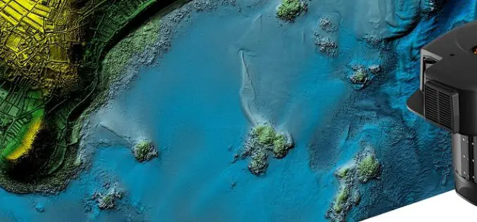
Leica’s New CoastalMapper LiDAR For Airborne Bathymetric Mapping
Leica Geosystems, part of Hexagon, has announced the launch of the Leica CoastalMapper. Thanks to a wider field of view and the ability to be flown at higher altitudes, the
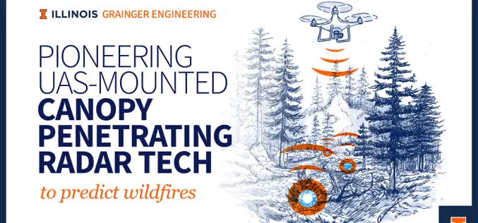
Illinois Scientists Advance Canopy-Penetrating Radar for Fire Prevention
Wildfires are unpredictable disasters that spread rapidly, leaving destruction in their path. Traditional remote sensing methods struggle to penetrate dense forest canopies, making it difficult to detect dry vegetation and

Kirinyaga Lands Department Establishes GIS Lab to Enhance GIS Land Management
In a significant move to enhance land management and service delivery, Kirinyaga County, Kenya, has established a state-of-the-art Geographic Information System (GIS) laboratory. This initiative aims to digitize all land

India Strides in Soil Health Monitoring Through the Soil Health Card
The Government of India has made significant strides in Soil Health Monitoring through the Soil Health Card (SHC) Scheme, launched in 2014-15. This initiative aims to improve soil fertility and
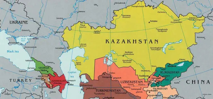
Kazakhstan Introduces National Geodetic Coordinate System to Enhance Spatial Data Infrastructure
Kazakhstan has launched its National Geodetic Coordinate System to strengthen its spatial data infrastructure, ensuring accurate geospatial information for various sectors, including land management, urban planning, and environmental monitoring. The
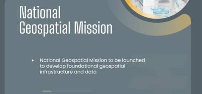
AI and Geospatial Initiatives Get a Rs 20K Boost in India’s 2025 Budget
The Indian government has allocated ₹20,000 crore in the Union Budget 2025-26 to drive research in artificial intelligence (AI), geospatial technologies, and innovation. The move is aimed at strengthening India’s

Three Advanced Iran Remote Sensing Satellites to Boost National Space Program
Iran is set to unveil three cutting-edge, indigenous satellites, significantly enhancing its capabilities in space technology. The satellites – two upgraded remote sensing satellites, Pars-1 and Pars-2, and the Navak
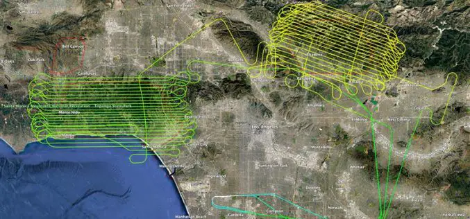
NV5 Releases LiDAR Data to Aid Los Angeles Wildfire Recovery
NV5, a leading provider of geospatial solutions, has released lidar data for the Palisades Fire and Eaton Fire burn areas. The dataset, made publicly available through the U.S. Geological Survey
