How Digital Utility Maps Support Safer Infrastructure Planning
Infrastructure planning has always depended on one essential question: what is already in the ground? Before a road is widened, a housing development is approved, a drainage system is redesigned, or a utility corridor is upgraded, planners need a clear view of existing assets. Water lines, gas mains, fiber cables, storm drains, electrical routes, and wastewater networks all shape how safely and efficiently a project can move forward.
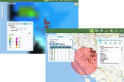
Digital utility maps help answer that question with greater speed, clarity, and confidence. Instead of relying only on paper records, isolated spreadsheets, or outdated drawings, project teams can use location-based data to understand where utilities are, how they relate to nearby infrastructure, and what risks may need attention before construction begins.
For cities, engineers, developers, and utility owners, this shift is not just about convenience. It directly supports safer decisions, better coordination, and more responsible infrastructure planning.
What Are Digital Utility Maps?
Digital utility maps are geospatial records that show the location and details of utility assets in a digital environment. These maps may include underground and above-ground infrastructure, such as:
- Water and sewer lines
- Gas pipelines
- Electric cables and conduits
- Telecommunications and fiber networks
- Stormwater systems
- Manholes, valves, meters, poles, and access points
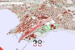
Many digital utility maps are built using Geographic Information Systems, or GIS. GIS allows teams to store, manage, analyze, and display utility information in relation to real-world locations. This makes it easier to see not only where assets are located, but also how they connect with land parcels, roads, buildings, flood zones, easements, and future project limits.
A useful digital map does more than show lines on a screen. It becomes a working decision tool.
Why Accurate Utility Data Matters in Planning
Infrastructure projects often become risky when teams work with incomplete or uncertain utility information. A missing line, an incorrect depth, or an outdated asset record can lead to serious problems during design and construction.
Inaccurate utility data may cause:
- Accidental utility strikes
- Construction delays
- Emergency service interruptions
- Costly redesigns
- Safety risks for workers and the public
- Conflicts between planned improvements and existing assets
Digital utility maps reduce these risks by giving planners a stronger foundation before fieldwork begins. When teams can view reliable utility information early in the planning process, they can identify conflicts, adjust alignments, phase work more carefully, and communicate risks before crews arrive on site.
This is especially important in dense urban areas, older neighborhoods, industrial zones, and fast-growing communities where utility networks may have expanded over many decades.
Supporting Safer Design Decisions
Safety begins long before excavation. It starts during planning and design, when engineers and project managers evaluate existing conditions and determine how new infrastructure should fit within a site.
Digital utility maps help teams design around known constraints. For example, a proposed storm drain route may need to avoid a major water transmission line. A roadway improvement may require careful coordination around buried fibre optic cables. A new development may need utility extensions that connect safely to existing networks without overloading them.
With digital maps, planners can compare utility layers with proposed design elements. This allows them to spot conflicts early and make informed changes before those conflicts become field problems.
Improving Coordination Between Teams
Infrastructure planning usually involves many groups. Engineers, surveyors, contractors, utility owners, municipal departments, environmental specialists, emergency responders, and public agencies may all need access to the same information.
Without a shared digital system, teams can end up working from different versions of the truth. One department may have updated utility records, while another still uses older drawings. A contractor may receive a PDF that does not reflect recent field changes. A planner may make assumptions because asset data is stored in a separate system.
Digital utility maps help reduce this fragmentation. They create a central reference point that different teams can use throughout the project lifecycle. As Pape-Dawson explains in its discussion of GIS utility mapping, modern mapping improves data reliability, system modeling, and cross-department collaboration, all of which are essential for better utility management.
When teams share clearer information, they can plan with fewer surprises.
Reducing Construction Disruptions
Construction disruptions are often expensive and stressful. A utility conflict discovered during excavation can stop work, require emergency coordination, and force design changes under pressure. In some cases, it can interrupt service to homes, businesses, hospitals, schools, or critical facilities.
Digital utility maps help reduce these disruptions by supporting earlier risk detection. Planners can review utility locations during feasibility studies, preliminary design, permitting, and construction planning. They can also use the maps to prioritize additional investigations, such as subsurface utility engineering, survey verification, or field locating.
This does not mean digital maps replace on-site verification. They should be part of a broader risk management process. However, they give teams a more organized starting point and help direct field efforts where they are most needed.
Strengthening Emergency Preparedness
Utility information is also critical during emergencies. When a water main breaks, a gas leak occurs, or severe weather damages infrastructure, response teams need to understand the affected network quickly.
Digital utility maps can support emergency preparedness by showing:
- Nearby shutoff valves
- Asset ownership and responsibility
- Access points and service areas
- Critical facilities that may be affected
- Alternative routes or system connections
- Areas with higher exposure to flooding or other hazards
This information helps agencies respond faster and with better situational awareness. In an emergency, minutes matter. A well-maintained digital utility map can help decision-makers act with greater confidence.
Helping Communities Plan for Growth
Growing communities face constant pressure to expand roads, housing, drainage, water service, broadband access, and public facilities. These improvements must be planned around existing infrastructure while also preparing for future demand.
Digital utility maps help communities understand capacity, coverage, and constraints. Planners can see where service gaps exist, where aging assets may need replacement, and where future development may require major upgrades.
This is especially valuable for long-range capital planning. Instead of reacting to problems one project at a time, cities and utility owners can use digital maps to plan investments more strategically.
Enhancing Public Communication
Infrastructure projects often affect residents and businesses. Road closures, utility upgrades, service interruptions, and construction schedules can create public concern. Clear communication helps build trust.
Digital maps can support public engagement by turning complex infrastructure information into visual, understandable formats. Project teams can use map-based exhibits, dashboards, and planning graphics to explain where work will occur, why it is needed, and how impacts will be managed.
This does not mean every utility detail should be publicly displayed, especially when security or privacy concerns apply. But carefully prepared map visuals can help communities understand project goals and timelines more easily than technical drawings alone.
Making Utility Records More Useful Over Time
One of the strongest benefits of digital utility mapping is that records can be improved over time. When field crews verify an asset location, complete a repair, install a new line, or discover a discrepancy, that information can be added back into the system.
This creates a continuous improvement cycle. The map becomes more accurate as projects are completed, inspections are performed, and assets are maintained. Over time, this improves planning quality for future work.
For this to happen, organizations need clear data standards and update procedures. A digital map is only as useful as the quality of the information behind it. Strong governance helps ensure that records remain current, consistent, and trusted.
Key Benefits of Digital Utility Maps
Digital utility maps support safer infrastructure planning in several practical ways:
- Better visibility: Teams can see utility networks in relation to roads, parcels, buildings, and project boundaries.
- Earlier conflict detection: Potential clashes can be identified before construction begins.
- Improved coordination: Departments and project partners can work from shared information.
- Reduced risk: More accurate planning helps lower the chance of utility strikes and service interruptions.
- Faster response: Emergency teams can locate critical assets and access points more quickly.
- Smarter investment: Utility owners can plan maintenance, replacement, and expansion with better data.
Building Safer Projects With Better Information
Safe infrastructure planning depends on knowing what exists, where it is located, and how it may affect future work. Digital utility maps give project teams a clearer way to manage that information.
They do not eliminate every risk. Field verification, professional judgment, and careful construction practices are still essential. However, digital mapping gives planners a stronger foundation for making safe, coordinated, and cost-effective decisions.
As infrastructure systems become more complex, communities need tools that help them plan with accuracy and foresight. Digital utility maps provide support by connecting data, people, and places in one practical view. For modern infrastructure planning, that connection is no longer optional. It is a key part of building safer, more resilient communities.