
Business

Esri and Trimble Offer the R1 GNSS Receiver to Enhance Field GIS Workflows
Professional-Grade GPS Accuracy Now Available for Collector for ArcGIS App Redlands, California—Esri announced today the availability of the Trimble R1 Global Navigation Satellite System (GNSS) receiver for collecting professional-grade GPS

BAE Systems to Develop Airborne Mine-Hunting LIDAR for Manned and Unmanned Aircraft
Electro-optics engineers at BAE Systems are designing a multi-sensor suite and onboard processing to detect, identify, and pinpoint moored and drifting sea mines from manned and unmanned aircraft. Officials of the

Topcon Announces Rotary-wing UAS
LIVERMORE, Calif. – October 5, 2015 – Topcon Positioning Group announces the addition of a rotary-wing unmanned aerial system (UAS) to its mass data collection solutions line. The Falcon 8

Learn to Make Decisions Using Lidar Data and Geographic Information Systems
New Esri Workbook Teaches Analysis Skills, Combining Lidar Data and ArcGIS Software Redlands, California—A new book published by Esri teaches how to use geographic information system (GIS) software to analyze

OGC Adopts Updated KML Earth Browser Standard – KML 2.3
The Open Geospatial Consortium (OGC®) announces that the OGC membership has approved the OGC KML 2.3 Standard. KML is an XML grammar used to encode and transport representations of geographic
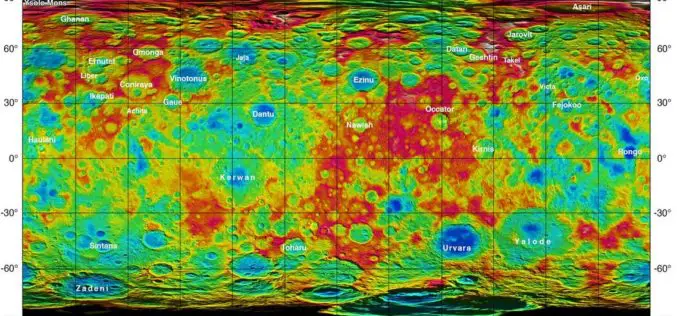
Dwarf Planet Ceres – New Name, New Maps, New Questions
This week, scientists at the European Planetary Science Conference (EPSC) in Nantes, France are busy with the mysterious crater structures and fascinating views of the multifaceted dwarf planet Ceres. The

Trimble Introduces Next Generation Indoor Mobile Mapping System for Building Interiors and Underground Structures
TIMMS 2—Smaller, Lighter and Easier to Maneuver System Maximizes Performance in Indoor Spaces While Delivering Accurate, High-Quality Data SUNNYVALE, Calif., Sept. 29, 2015—Trimble (NASDAQ: TRMB) introduced today its next generation Trimble®
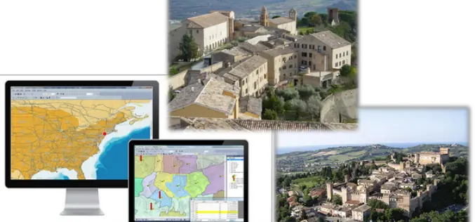
Italian Historic Treia City Uses SuperGIS Desktop for Urban and Tourism Planning
Supergeo Technologies Inc., the GIS software and solution provider, announces that Treia City, Italy enhances its urban planning with SuperGIS Desktop, the powerful GIS software developed by Supergeo. Located in the
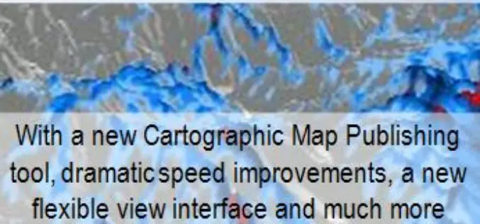
Global Mapper v17 Now With New Multi-View Interface and Enhanced Cartographic Layout Tools
Blue Marble Geographics has announced the release of Global Mapper version 17. This major release offers numerous new and improved geospatial tools, functional upgrades, and performance improvements throughout all areas of
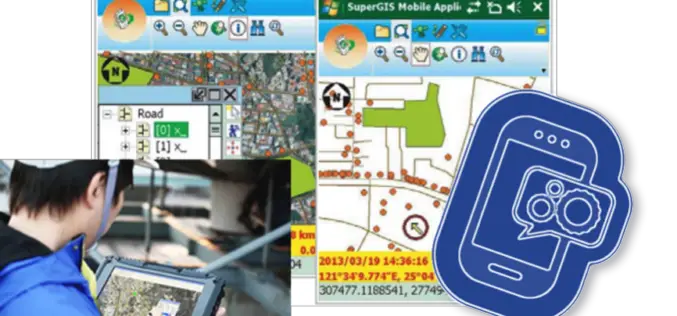
Need a Custom Windows Mobile App? Build with SuperGIS Mobile Engine!
Start make your own application on Windows Mobile Platform! Supergeo recently announced an update version of SuperGIS Mobile Engine, which greatly enhances the accessibility, the reliability and most of all,
