
Business
OmniEarth Applies Machine Learning to Multiple Satellite Sources for Improved Soil Moisture Mapping
The US Defense Advanced Research Projects Agency (DARPA) has awarded OmniEarth a Small Business Innovation Research (SBIR) Phase I contract to develop a precision soil moisture mapping model in support
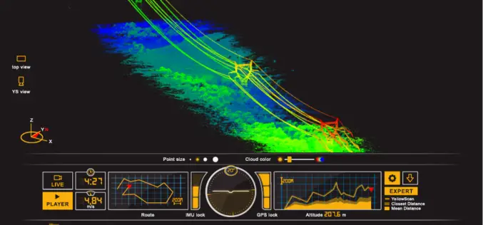
ILMF 2017: YellowScan Launches YellowScan LiveStation
ILMF 2017: YellowScan launches YellowScan LiveStation, Real-time in-flight LiDAR Station, a must for long endurance and critical LiDAR flights Yellowscan is very pleased to announce the launch of the YellowScan
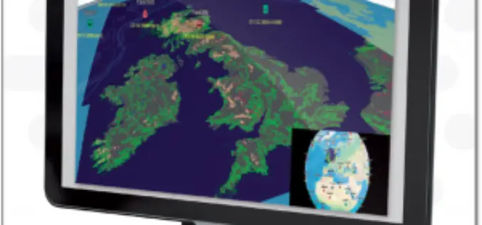
ENVITIA Launches MapLink Pro 10.0
ENVITIA is proud to announce the release of the next generation of MapLink Pro centered around the theme of speed. Speed in visualization of dynamic data, speed in the manipulation

DigitalGlobe Completes Testing and Calibration of WorldView-4 and Begins Serving the Satellite’s First Direct Access Customer
WorldView-4 completed its testing and calibration phase and began serving its first direct access customer on February 1st 2017. WESTMINSTER, Colo.–(BUSINESS WIRE)–Feb. 3, 2017– DigitalGlobe, Inc. (NYSE: DGI), the global
NovAtel Unleashes Powerful New Positioning Capabilities with the Release of 7.200 Version Firmware
Calgary, Canada, February 2, 2017 – NovAtel’s commitment to precise, ASSURED positioning is central to the launch of our OEM7 7.200 version firmware. Announced today in Calgary, 7.200 firmware introduces
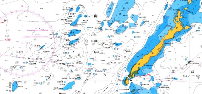
East View Expands South China Sea Imaging Capabilities
MINNEAPOLIS, Minn. – January 31, 2017 – East View Geospatial is enthusiastic to announce the expansion of analytic services in the South China Sea for foundation data and satellite imagery.

Putting Disease on the Map
Esri Book Offers a Sweeping Historical Overview of Medical Mapping in a New, Expanded Edition of Cartographies of Disease: Maps, Mapping, and Medicine January 31, 2017 – Redlands, California—The new

GeoSLAM Launches Desktop V3
GeoSLAM is delighted to announce the launch of Desktop V3, the latest release of their industry leading SLAM registration software. January 31, 2017 – GeoSLAM Desktop V3 builds on the success
Siemens and Bentley Systems Agree to Jointly Offer Planning and Design Solutions for Utilities
San Diego, U.S.A. – DistribuTECH 2017 – Building on the strategic alliance between Siemens and Bentley Systems that was made public in November 2016, Siemens’ Energy Management Division and Bentley
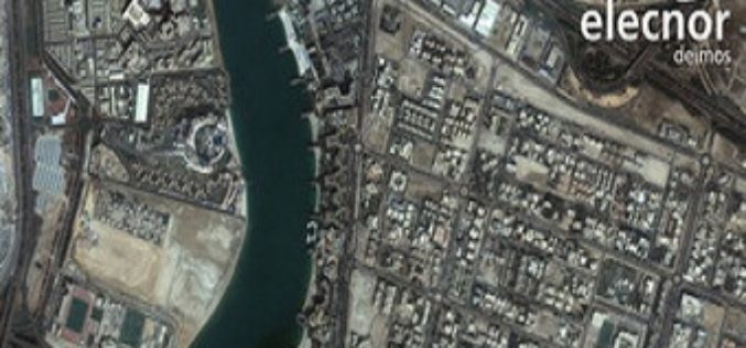
Ordnance Survey International Helps the UAE Manage Climate Change
Ordnance Survey International and Deimos Space UK are to work with the Mohammed bin Rashid Space Centre in Dubai to help the United Arab Emirates (UAE) improve how it plans and
