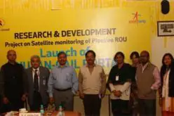
Esri India and Dhruva Space Partner to Launch Advanced Satellite Imagery Service

Esri India and Dhruva Space have entered into a strategic Memorandum of Understanding (MoU) to transform geospatial intelligence in India by integrating their technologies and leveraging a satellite imagery service offering from Dhruva’s AstraView platform.
Explain
Under this alliance, Dhruva Space’s AstraView — which aggregates data from over 200 Earth Observation (EO) satellites with multiple sensor types including optical, SAR, radio-frequency (RF), and hyperspectral — will be combined with Esri India’s ArcGIS software suite. This integration aims to enable GIS professionals, government bodies, and private sector users to access, analyze, and act upon rich geospatial data more easily.
Example
For instance, urban planners will be able to overlay high-resolution optical satellite data and hyperspectral sensor data onto existing GIS maps to better assess land use and vegetation health. In agriculture, farmers and policy makers could monitor crop stress or water usage using multispectral and RF data through the same unified workflow. Disaster management authorities might use SAR imagery during floods or heavy rains, when optical data may be obscured by clouds. All of these rely on fast access to the satellite imagery service in a form that is already integrated in tools like ArcGIS.
Also Read: Department of Posts Strengthens DIGIPIN with ESRI India MoU
Tell-why
This collaboration matters because geospatial intelligence plays a growing role in national security, infrastructure development, climate resilience, agriculture optimisation, and smart city planning. By combining AstraView’s data reach with Esri’s mature GIS platform, decision-makers can move faster, with greater accuracy, reducing dependency on external data sources. It also supports India’s push for self-reliance in space-tech and data sovereignty.
Action
Going forward, both Esri India and Dhruva Space plan to roll out this integrated capability through Esri India’s user base, which includes government, academic, and private sector users. They will also look for opportunities to co-develop solutions tailored for sectors like agriculture, urban planning, disaster response, and environmental monitoring. The aim is to make the satellite imagery service not just a backend dataset, but a core feature in everyday decision making.
Source: CXOToday.com