
Free Interactive 3D Globe Allows Everyone to Visualize, Explore, and Understand Spatial Data
Esri, the world leader in mapping technology, has launched ArcGIS Earth, a free, desktop-based interactive globe that anyone can use to explore the world and work with a variety of 3D and 2D map data formats including KML. ArcGIS Earth allows users to quickly display data on the globe, sketch place marks, measure distances and areas, and add annotations to easily understand spatial information.
“ArcGIS Earth is a revolutionary desktop application that offers GIS to the world,” said Jack Dangermond, Esri founder and president. “It supports spatial data formats and workflows that are familiar to your enterprise. It is a core component of Esri’s secure, stable, and mature ArcGIS platform, and it’s another tool for serving all your internal and external users through GIS.”

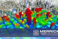
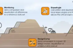
Demand for 3D mapping continues to grow among Esri customers in industries as diverse as national and local government, urban design and planning, and commercial space management. These customers are using 3D to visualize plans and conditions, understand the behavior and aesthetics of proposed development, and communicate ideas in the context of real-world imagery and data. ArcGIS Earth allows users to examine interrelationships of assets in 3D, report project status, and present work to stakeholders or clients in a compelling and interactive experience. ArcGIS Earth is designed to provide a high-performance globe viewer with an immersive user interface.
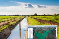
ArcGIS Earth users can explore open standard KML and KMZ data, shapefiles, imagery, and web services; tilt and rotate the view; measure distances and areas on the globe; and supplement maps with sketches and annotations. ArcGIS Earth includes free content that encompasses global imagery, topographic maps, world ocean maps, OpenStreetMap, and publicly available maps shared by millions of ArcGIS users around the world.
“Enterprise customers can use ArcGIS Earth to put the power of mapping into the hands of anyone in a large organization who needs to reliably access a map,” said Chris Andrews, Esri product manager for ArcGIS Earth. “The application combines a familiar, immersive, globe-based experience that is accessible by nontechnical users, with the power to access any data stored in the ArcGIS platform. With ArcGIS Earth, we are adding an option to help our users share the value of GIS throughout their organizations or even beyond.”
ArcGIS Earth is fully integrated with the ArcGIS platform—on-premises and in the cloud—for the secure access, sharing, and publishing of enterprise maps and data, and continued operations with minimal interruption. Users with an ArcGIS account can access secured data in ArcGIS Online or ArcGIS for Server including feature, scene, map, and image services.
ArcGIS Earth is also part of Esri’s offer for Google customers and partners looking to transition to Esri software following the deprecation of Google Earth Enterprise. Along with other capabilities of the ArcGIS platform, ArcGIS Earth provides an alternative to Google Earth Enterprise Client. To learn more about the offer, visitesri.com/google.
Download ArcGIS Earth for free today. Get started at esri.com/earth.


Could it provide me all possible basin area to be get demarcated with higher accuracy than Google earth.