
Tag "ArcGIS Earth"
What’s New in ArcGIS Earth v1.8?
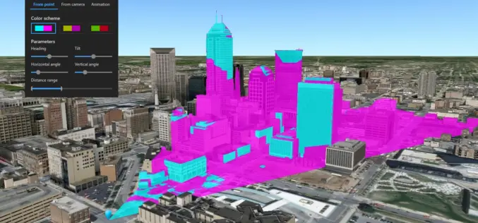
Recently Esri has introduced the latest version of ArcGIS Earth v1.8. ArcGIS Earth 1.8 delivers interactive analysis tools such as elevation profile, 3D measure, line of sight, and viewshed—with much more
Download for Free – Esri Release ArcGIS Earth 1.4
Recently Esri 3D team has announced the release of ArcGIS Earth 1.4. ArcGIS Earth 1.4 introduces great new features that will enhance workflows for visualizing data, accessing portals, and sharing across
ArcGIS Earth Just Got Even Better With Launch of ArcGIS Earth 1.3
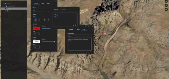
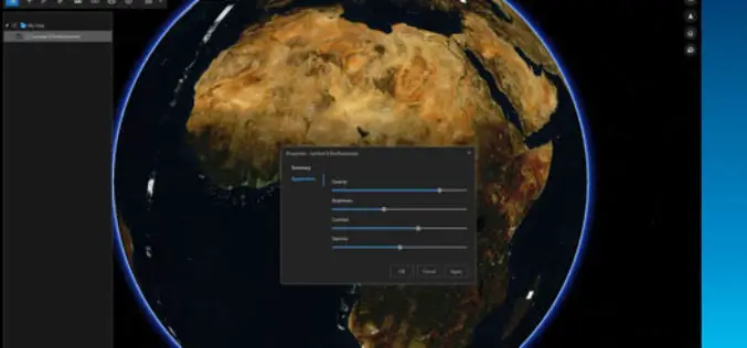
ArcGIS Earth 1.3 with Control Vertical Exaggeration and Image Properties With ArcGIS Earth 1.3 you can now do more with terrain, imagery, and KML. You will also discover authentication improvements

What’s New in ArcGIS Earth 1.2
ArcGIS Earth is off to a great start with thousands of downloads and an engaged community of global users. We are happy to release the 1.2 version and excited to

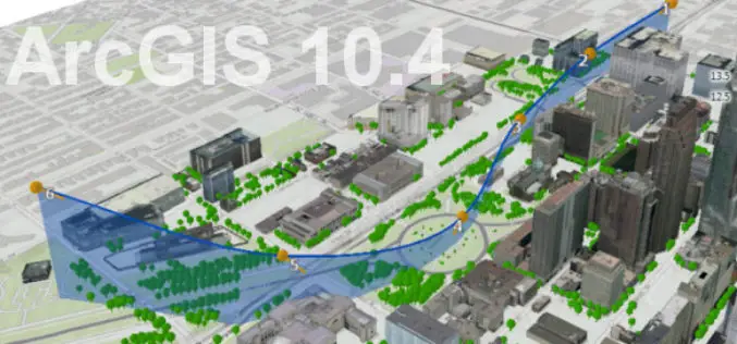
Esri India Webinar: What’s new in ArcGIS 10.4 Desktop?
Esri India Webinar: What’s new in ArcGIS 10.4 Desktop? 2nd June 2016, 11:00 AM IST onwards ArcGIS 10.4, the latest release, includes exciting new capabilities for visualizing and analyzing data.
What’s New in ArcGIS Earth 1.1
ArcGIS Earth, a free, desktop-based interactive globe that anyone can use to explore the world and work with a variety of 3D and 2D map data formats including KML. ArcGIS
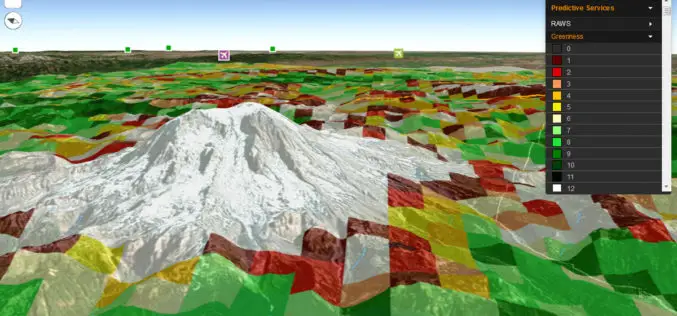
Fire Globe Delivers Esri 3D Visualization to US Firefighters
The National Interagency Fire Center Migrates to the Esri Platform and Improves Situational Awareness Redlands, California—The National Interagency Fire Center (NIFC) has transferred its web GIS application, Fire Globe, to

Vricon Joins Esri Partner Network to Expand Use of High-Resolution 3D Geodata
Redlands, California—Vricon, a leading provider of photo-realistic 3D mapping products and digital elevation models for the defense and security industries, is now a member of the Esri Partner Network. Vricon’s
What’s New With ArcGIS 10.4?
Data Visualization, Enterprise Resiliency Lead ArcGIS 10.4 Rollout The release of ArcGIS 10.4 marks improvements in data visualization, spatial analysis, and stronger support for on-premises implementations. “This release of ArcGIS
Esri Unveils ArcGIS Earth to the World
Free Interactive 3D Globe Allows Everyone to Visualize, Explore, and Understand Spatial Data Esri, the world leader in mapping technology, has launched ArcGIS Earth, a free, desktop-based interactive globe that
