
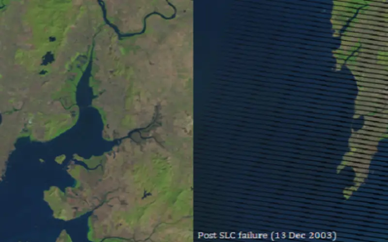
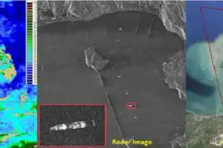
On May 31, 2003, the Scan Line Corrector (SLC), which compensates for the forward motion of Landsat 7, failed. Subsequent efforts to recover the SLC were not successful, and the failure appears to be permanent. Without an operating SLC, the Enhanced Thematic Mapper Plus (ETM+) line of sight now traces a zig-zag pattern along the satellite ground track (Figure 1). As a result, imaged area is duplicated and causing the scanning pattern to exhibit wedge-shaped scan-to-scan gaps.
The ETM+ has continued to acquire data with the SLC powered off, leading to images that are missing approximately 22 percent of the normal scene area.
When operating nominally, the SLC deflects the ETM+ line-of-sight in the along-track direction to ensure that the sensor’s bi-directional cross-track scanning pattern provides continuous coverage of the full Landsat swath [Landsat Project Science Office, 1998]. Without this compensation, the resulting zigzag scanning pattern exhibits wedge-shaped scan-to-scan gaps, alternating with scan-to-scan overlap, of increasing magnitude away from nadir. Figure 1 (a) and 1 (b) shows an example of the impact of the SLC failure on ETM+ imagery.
If you wish to download data for exercise can download from USGS EarthExplorer

Figure 1 (a) Pre SLC Failure (15 Dec 2002)
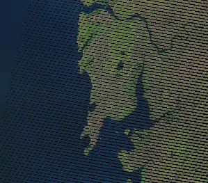
Figure 1 (b) Post SLC failure (13 Dec 2003)
The method to gap filling using ERDAS image processing software includes following steps:
1. Stacking of bands of Landsat 7 (ETM +):
- Extract all the bands form the zip folder of the Landsat 7 obtained from USGS EarthExplorer.
- Open ERDAS Imagine
- Click the Interpreter Icon in the Main Menu.
- Select Utilities in the Image Interpreter Menu.
- Select Layer Stack in the Utilities Menu.
- The Layer Selection and Stacking Input/Output box is displayed.
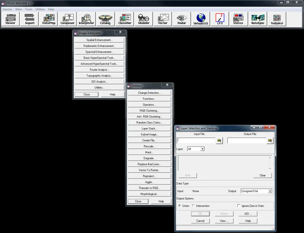
- To stack the bands, browse the bands using Input File option. Select one by one all bands (except Band 6 – thermal band and Band 8- panchromatic band). Use Add button to add bands.
- Give name to output image in a suitable folder.
- Select Output Data Type as Unsigned 8 bit as the Input data type is also a Unsigned 8 bit.
- Click Ok, model will run and generate a stacked image of Landsat 7 bands.

2. Gap Filling Method:
- Click the Interpreter Icon in the Main Menu.
- Select Spatial Enhancement in the Image Interpreter Menu.
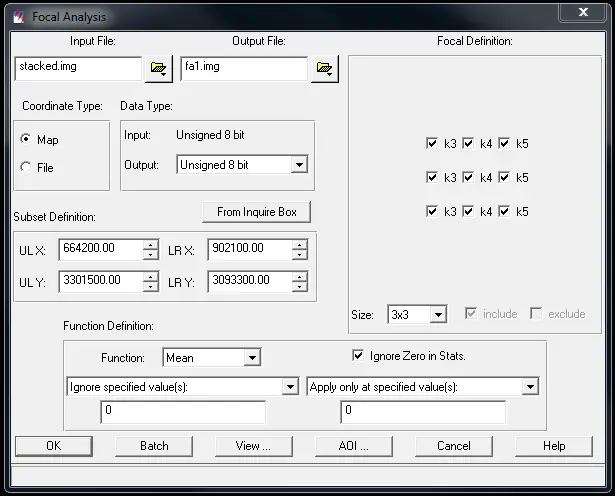
- Select Focal Analysis in the Spatial Enhancement Menu.
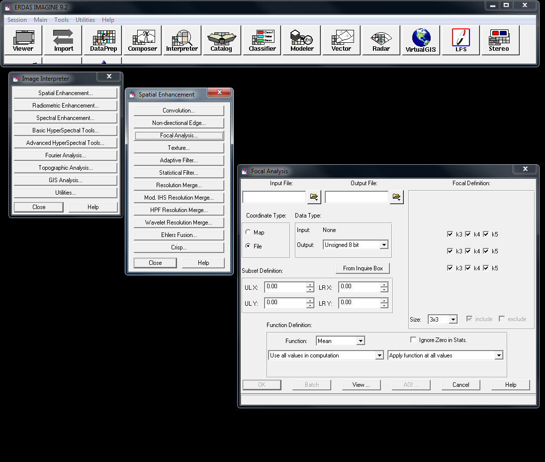
- In Focal Analysis window, browse the input file (stacked image obtained after layer stacking).
- Give an Output name to the image.
- Select Unsigned 8 bit as Output data type.
- In Function definition box, select Mean as Function and check Ignore Zero in Stats.
- In drop down menu select Ignore specified value (s) and Apply only at specified value (s).
- Leave the default value as 0 and 0.
- Click Ok, model will run and will generate an output image when processing is done.
- Repeat the above steps for six or 7 times (preferably). Please note that the input file every new Focal Analysis will be the immediate previous output file of Focal Analysis.
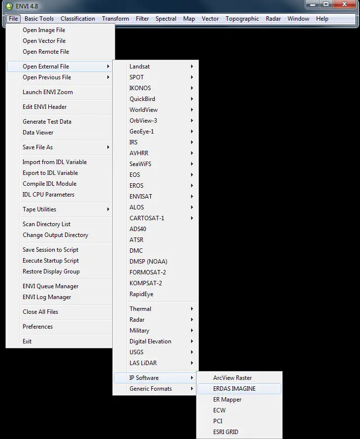
Although ERDAS Imagine can be used to finalize the image, but here is an exposure on how to use ENVI to finalize a Landsat 7 SLC-off image for further uses.
- Open Envi
- Click File from menu bar
- Select Open External File
- Select IP Software then use ERDAS Imagine
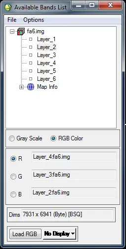
- Browse the last file of Focal Analysis (in this case fa6.img).
- Select RGB option then click Band 4 (NIR), Band 3 (Red) and Band 2 (Green) to generate a RGB image.
- Click Load RGB. This will generate a RGB image free of SLC error.
- Then save the image either in GeoTiff/Tiff or .img format for further use in analysis.
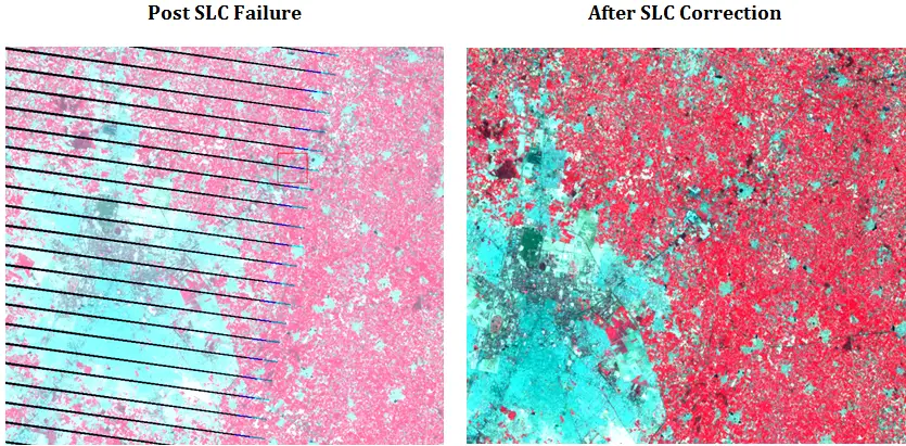
Results:
Following are the result of Gap filled exercise using ERDAS imagine for Landsat 7 SLC – Off.
You may like to read:


excellent post……..really helpful………..