© Heather Killen photo Brad Benham, a mapping student at the Centre of Geographic Sciences, is reading over last year’s weekly police reports in order to compile a crime map for the county.
Crime Analysis using GIS
A COGS student is hoping that last year’s crime reports will help local police predict patterns in this year’s 911 calls.
Brad Benham, a mapping student at the Centre for Geographic Sciences, is reading over last year’s weekly police reports in order to compile a crime map for the county.
He has chosen to do this map as his research project towards his certification in Geographic Information Systems (GIS). He says police have been using GIS as a tool to better understand and tackle crime for about the past 10 years.
“I thought this project would be a good thing for me to do because it has practical applications for the real world,” he said.
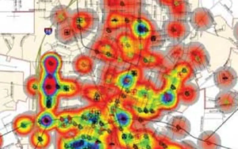
Benham’s project aims to plot the criminal activity across the county, showing the criminal patterns within communities and helping police and criminal analysts to predict the potential for future crime.
Pinpointing areas with high crime rates, or ‘hot spots,’ help police better plan their patrols and checkpoints to provide a more focused and effective presence.
He says he will create a database that is capable of tracking variables and isolating specific information that can offer insight into the who, what, where, when, and why of local crimes.
This project will be completed over the winter in four stages. First, he collects the information from the Annapolis County Spectator into a database marking the location of the crime event.
Each location will be assigned a geocode place on a map and then he will input the other variables to process and analyze the data for his final report.
This map will look at the possible relationships between the types of crimes being committed, their locations and times. Benham’s map may also include relevant socio-economic information collected from the Census.
This information could compare crime rates with income levels, factoring in other data such as education, and employment opportunities. He says he wants to indicate crime variables using factors such as times of day, the number of suspects, dates, season, and the type of crime.
He will also look at the geographical distance and response times for emergency vehicles using network analyst extension and spatial statistics tools.
Read original story at The Annapolis County Spectator


