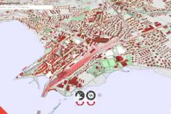
 Mumbai, India – According to recent news by The Indian Express, Mumbai city development authority has tied up with the World Bank to map the entire Mumbai Metropolitan Region (MMR), mirroring every road, utility, water body and plan reservation across eight municipal corporations, nine municipal councils and about a thousand villages on a digital platform.
According to the Mumbai Metropolitan Region Development Authority (MMRDA), the ambitious Regional Information System that it aims to create with the World Bank’s help will be the first of its kind in India.
The World Bank will guide MMRDA in planning the project, assess needs, identify information gaps, and identifying methods and technologies besides Geographic Information Systems to create the database.
The MMR is spread across 4,355 square kilometres, comprising the eight municipal corporations of Mumbai, Thane, Kalyan-Dombivli, Navi Mumbai, Ulhasnagar, Bhiwandi-Nizampur, Vasai-Virar and Mira-Bhayander. Besides the corporations, MMR also includes the nine municipal councils of Ambarnath, Kulgaon-Badlapur, Matheran, Karjat, Panvel, Khopoli, Pen, Uran and Alibaug, besides over a thousand villages in Thane and Raigad districts. The MMRDA is the planning authority in charge of the entire region. Most of these areas have haphazardly grown with several urban local bodies battling problems of illegal construction.


