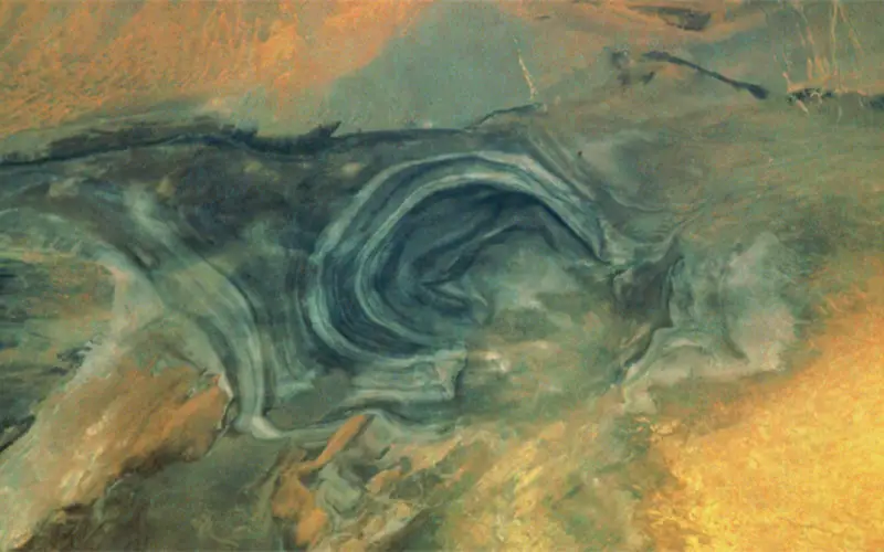
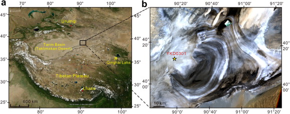
China’s “Great Ear” is the name for Lop Nor, located at the eastern end of the Tarim Basin. This name is clearly illustrated by the satellite image. The salt lake and surroundings plains of clay and salt layers are formed by the Tarim River, which evaporates after a long route through the desert. The river delta is visible at the western edge of the ear. The large river embankments of the chiefly dry lakes shine as varying layers of gray-green, sandy clays and white salt deposits-products of evaporation. These limn the level of the lake from the previous years. The darker inner part of the ear indicates moisture, which remains only in winter when the Tarim freezes over and scarcely any water flows into the lake. After the spring floods from the high mountains in the west, the lake is partially re-filled.
The location and appearance of Lop Nor has been a matter of dissension among scientists up to the 1920’s. Chinese and Greek sources reported more than 2000 years ago about the existence of the mysterious lake, located south of Lou-Ian, an old city on the Silk Route.
Seven Hedin, the famous explorer of Asia, re-discovered the ruins of this old town; he also succeeded in solving the enigma of Lop Nor. The solution was that the lake was located in another region, than that given in the historical sources. In addition, the lake is also partly of fresh water, which is unusual for a terminal lake in arid regions. Sven Hedin concluded, on the basis of his observations that the lake “wanders”: in addition to its annual shrinkages and growth according to water-flow, it also periodically changes its location.
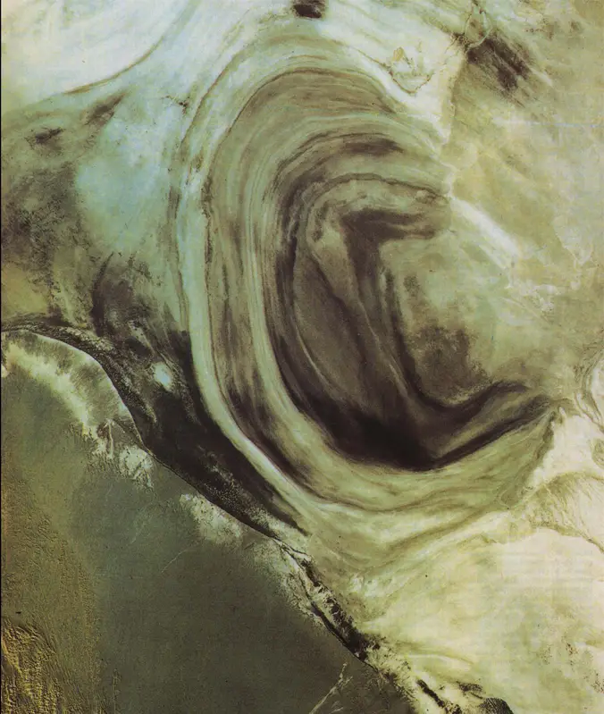
The reason for this is the large amount of sediments lead to a continual rising of the flat basin of the lake bed. Simultaneously, the water-free areas of the soft lake sediments are abraded by the sand blast of violent storms, and the basin is lowered in this area. A wind corrosion landscape is created, with forms named “Jardangs”. It is then only a matter of time, until the Tarim changes its bed and pours into the basin hollowed out by the winds.
Nature itself verified Seven Hedin’s theory in 1921, as Lop Nor again wandered north into the region, which had been described in the historical records.
Courtesy Horst Hagedorn