New research from a team of European scientists has found there is not enough satellite data to determine the rate of polar ice cap melt very far into the future and warned against using current trends to predict sea level rise that might result from melting glaciers.
The ice sheets on Greenland and Antarctica represent the biggest potential contributor to sea level rise. According to a study published last year including data from 1992 to 2011, the Greenland ice sheet lost around 2,000 billion metric tons of ice while the Antarctic experienced 1,300 billion metric tons in ice loss – resulting in an average sea level rise of just over 11 millimeters.
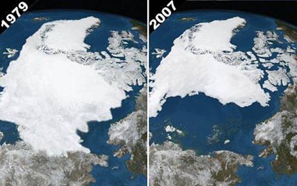
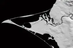
Arctic ice in September 1979 and 2007. By comparing the images we see the greatest reduction of glaciation since we started with satellite imagery. Photo NPA Ltd.
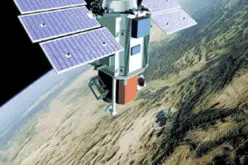
Since 2002, researchers have used the Gravity Recovery and Climate Experiment (GRACE) satellites to monitor minor variations in the Earth’s gravitational field that are caused by shifting mass distribution, such as from polar ice to the oceans. The data allows scientists to monitor the ice sheets on a monthly basis.
“In the course of the mission, it has become apparent that ice sheets are losing substantial amounts of ice – about 300 billion tons each year – and that the rate at which these losses occurs is increasing,” said Bert Wouters, a research fellow at the University of Bristol. “Compared to the first few years of the GRACE mission, the ice sheets’ contribution to sea level rise has almost doubled in recent years.”
The study was published in Nature Geoscience and describes how Wouters and a team of colleagues examined nine years of satellite data from the GRACE mission along with models of about 50 years of changes to the ice sheets. They said their ability to accurately find an accelerating movement toward mass loss relies on the extent of the record being used.
In a news bulletin, the University of Bristol scientists from the study said the ice loss observed by the GRACE satellites is more significant than expected from natural fluctuations. However, the acceleration of the loss over the more recent years is not.
The authors said they expect enough satellite data for accurately detecting ice loss in the Antarctic to be available soon, but an additional ten years of satellite would be needed for Greenland. Currently, using ice sheet data to determine sea-level rise through 2100 may be off by as much as 13 inches.
In reacting to the study, Wolfgang Rack of the University of Canterbury in New Zealand said he agreed with the notion of insufficient data for accurately calculating sea level rise.
“Although ice is lost beyond any doubt, the period is not long enough to state that ice loss is accelerating,” Rack told the Guardian. “This is because of the natural variability of the credit process, snowfall, and the debit process, melting, and iceberg calving, which both control the ice sheet balance.”
To emphasize the impact polar ice sheets have on sea levels, the Bristol researchers said both the Antarctic and Greenland ice sheets contain over 99 percent of Earth’s glacier ice and sea levels would rise over 200 feet if it were to melt completely.
Source: Brett Smith for redOrbit.com – Your Universe Online
Related Links:
GRACE: GRACE is a joint mission with the German Aerospace Center and the German Research Center for Geosciences, in partnership with the University of Texas at Austin. For more about GRACE.