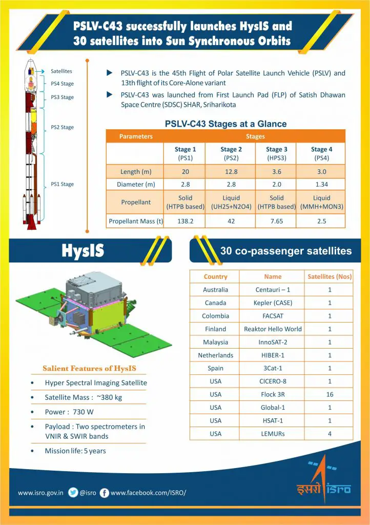
Nov 29, 2018 – ISRO – Today, the Indian Space Research Organisation’s (ISRO) Polar Satellite Launch Vehicle (PSLV-C43) successfully launched 31 satellites from Satish Dhawan Space Centre (SDSC) in Sriharikota.
The PSLV-C43 lifted off at 9:57:30 (IST) from the First Launch Pad and injected India’s Hyper-Spectral Imaging Satellite (HysIS) into the 645 km sun-synchronous polar orbit, 17 minutes and 19 seconds after the lift-off.
Later, 30 foreign satellites were injected into their intended orbit after restarting the vehicles fourth stage engines twice. The last satellite was injected into its designated orbit 1 hour and 49 minutes after the lift-off.
After separation, the two solar arrays of HysIS were deployed automatically and the ISRO Telemetry Tracking and Command Network at Bengaluru gained control of the satellite. The satellite will be brought to its final operational configuration in the next few days.
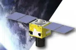
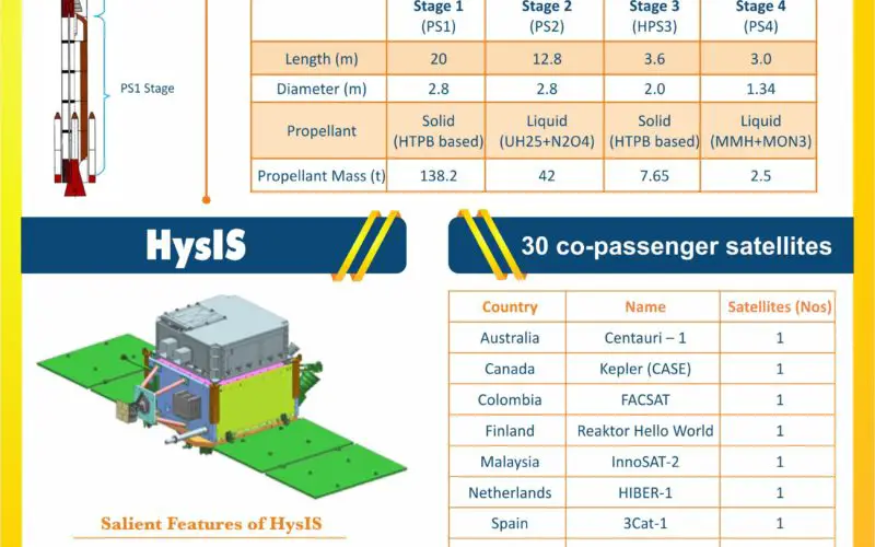
HysIS is an earth observation satellite built around ISRO’s Mini Satellite-2 (IMS-2) bus weighing about 380kg. The mission life of the satellite is five years.
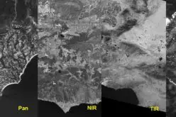
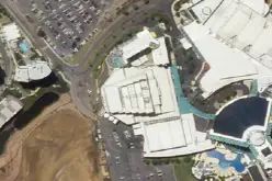
The primary goal of HysIS is to study the earth’s surface in both the visible, near infrared and shortwave infrared regions of the electromagnetic spectrum. Data from the satellite will be used for a wide range of applications including agriculture, forestry, soil/geological environments, coastal zones and inland waters, etc.
HysIS had the company of one micro and 29 nano-satellites from eight countries, including Australia (1), Canada (1), Columbia (1), Finland (1), Malaysia (1), Netherlands (1), Spain (1) and USA (23). The total weight of these satellites was about 261.50 kg. Satellites from Australia, Columbia, Malaysia and Spain were flown aboard PSLV for the first time. These foreign satellites launched are part of commercial arrangements between Antrix Corporation Limited and customers.
Credit: ISRO
ISRO Chairman Dr K Sivan said that the team has achieved another spectacular mission 15 days after the successful GSLV-MkIII/GSAT-29 launch.
“Today once again we have proved our excellence,” Dr Sivan said. He said HysIS is a state-of-the-art satellite with many indigenous components developed by SAC, Ahmedabad and SCL, Chandigarh.
“Our customers are very happy that their satellites are precisely delivered into orbit. We are ready for the next launch of GSAT-11 on December 5 from French Guiana and later GSLV-MkII will launch GSAT-7A from Sriharikota in December,” Dr Sivan added.
Mission Director R Hutton termed the launch as a grand and marvellous one with clockwork precision.
“We have used a lighter version of PSLV today. It has once again proven its capabilities to launch multiple satellites into different orbits. All our team members, their family members and industry partners have played a vital role,” Hutton said.
HysIS Project Director Suresh K said that the satellite is performing normally after the launch.
PSLV is a four stage launch vehicle with a large solid rocket motor forming the first stage, an earth storable liquid stage as the second stage, a high performance solid rocket motor as third stage and a liquid stage with engines as fourth stage.
Today’s was the 45th flight of PSLV and 13th one in the Core Alone configuration. So far, the PSLV has launched 44 Indian and nine satellites built by students from Indian universities. The vehicle has also launched 269 international customer satellites.
In the last PSLV launch on September 16, PSLV-C42 had successfully launched two commercial satellites from UK-based Surrey Satellite Technology Limited.