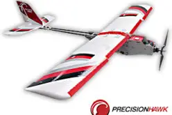
Successful Integration of the RIEGL VQ-840-G Topo-Bathymetric Laser Scanner into the Schiebel CAMCOPTER® S-100 UAS
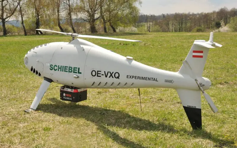
RIEGL Laser Measurement Systems GmbH and SCHIEBEL have successfully completed the integration of a high-end laser scanning system, the RIEGL VQ-840-G topo-bathymetric LiDAR sensor, on the Schiebel CAMCOPTER® S-100 Unmanned Air System (UAS).
Operating a high-end laser scanning system remotely on an Unmanned Air Vehicle (UAV) requires a tailored solution going beyond what is currently available off-the-shelf. In order to maintain the broad operating range of the UAS, it is imperative to keep the weight of the sensor payload low. In addition, the effective execution of the survey mission requires full remote control of the payload instruments and real-time feedback to the operator via a data link.
The compact topo-bathymetric laser scanner was designed for use in a variety of maritime and hydrographic environments. The LiDAR sensor payload system is controlled remotely via a data link, which is a crucial for the integration into the S‑100 system.
The scanner is controlled by using the onboard software “RiACQUIRE-Embedded” via the available data link; data acquisition and laser safety are also monitored. Once the survey is completed, the raw data seamlessly integrates into the RIEGL data processing workflow.
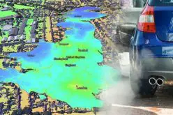
The RIEGL VQ-840-G, combined with the outstanding technical specifications and performance of the CAMCOPTER® S-100 UAS, enables an efficient and secure way for surveying shallow waters, where monitoring from boats becomes a challenge. The applications of Airborne LiDAR Bathymetry (ALB) include the mapping of coastlines and river banks as well as the monitoring of natural habitats, water reservoirs and hydraulic engineering applications (e.g., canals, dams, bridges). In a single data acquisition mission, data below and above the water surface are covered.
Additionally, the topographic laser scanners RIEGL VUX-1UAV/-LR and VUX-12023 can be integrated in the front payload bay of the CAMCOPTER® S-100.
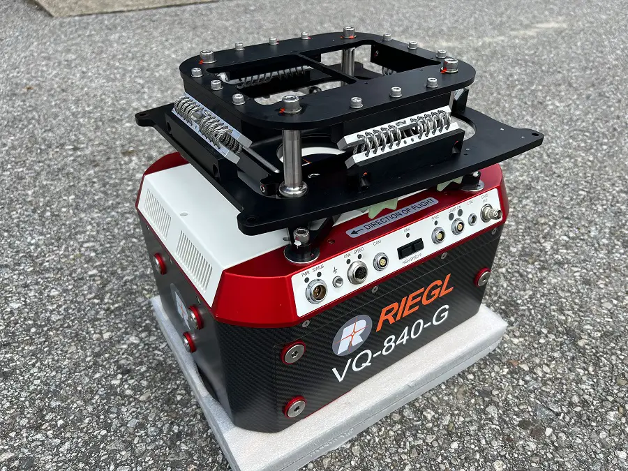
Top: shock absorbing mounting plate installed on top of the laser scanner
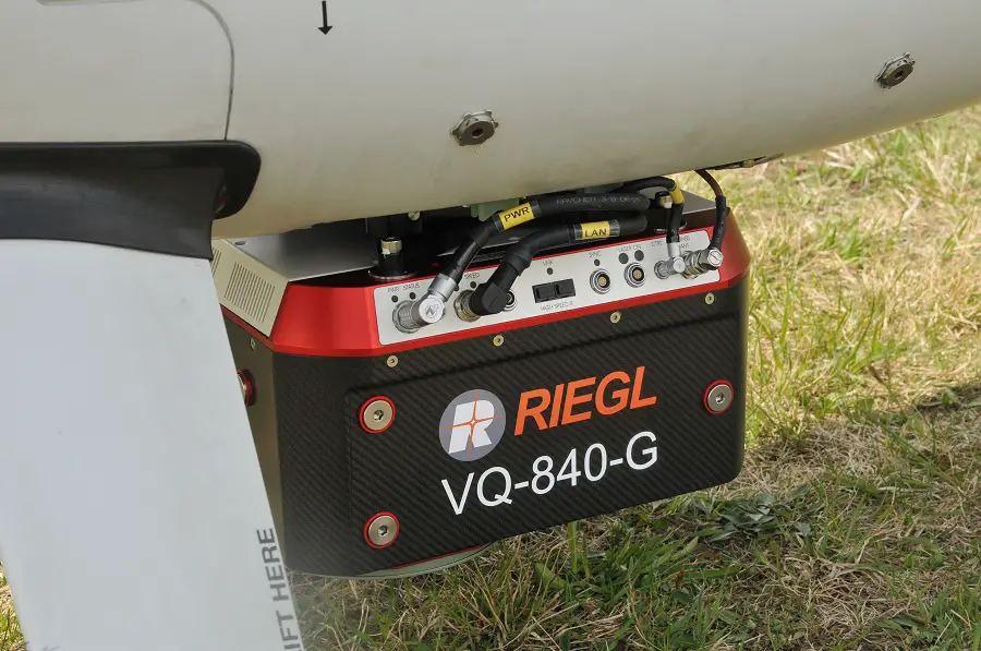
Bottom: payload installed on S-100 fuselage
About RIEGL
With more than 40 years of experience in the research, development and production of laser rangefinders, distance meters, and LiDAR sensors and systems RIEGL delivers proven innovations in 3D.
The combination of RIEGL‘s state-of-the-art hardware for terrestrial, industrial, mobile, airborne, bathymetric and UAV-based laser scanning with appropriate, equally innovative RIEGL software packages for data acquisition and processing results in powerful solutions for multiple fields of application in surveying.
RIEGL has always been committed to delivering the highest performance, quality, reliability, and longevity of all its products and services, and strict adherence to applicable international standards is a priority.
For more information, visit www.riegl.com
About RIEGL LiDAR Sensors and Systems for Bathymetry
Airborne LiDAR Bathymetry (ALB) is the technology of choice for surveying shallow water zones in coastal areas, for river bank surveys, natural habitat monitoring, and hydro engineering applications. In a single data acquisition mission both, data below and above the water surface, are covered.
RIEGL’s ALB systems are also ideally suited to provide complementing data as part of large-scale and deepwater surveys conducted using other surveying methods.
RIEGL provides several topo-bathymetric systems – the VQ-880-G II and the VQ‑880-GH – for integration with crewed fixed-wing aircraft and helicopters. For installation on drones and / or crewed platforms, the compact VQ-840-G and VQ‑840‑GL topo-bathymetric laser scanners are available.
About Schiebel
Founded in 1951 in Vienna, the globally operating Schiebel Group focuses on the development, design and production of the revolutionary CAMCOPTER® S-100 Unmanned Air System (UAS). Certified to meet AS/EN 9100 standards, Schiebel has built an international reputation for producing high-tech military, commercial and humanitarian products, which are backed by exceptional after-sales service and support. Schiebel has facilities in Vienna and Wiener Neustadt (Austria), Manassas, VA (USA), Abu Dhabi (UAE), and Shoalhaven (Australia).
About the CAMCOPTER® S-100
Schiebel’s CAMCOPTER® S-100 Unmanned Air System (UAS) is an operationally proven capability for military and civilian applications. The Vertical Takeoff and Landing (VTOL) UAS requires no prepared area or supporting equipment to enable launch and recovery. It operates by day and by night, under adverse weather conditions, with a beyond line-of-sight capability out to 200 km / 108 nm, over land and sea. Its carbon fiber and titanium fuselage provides capacity for a wide range of payload/endurance combinations up to a service ceiling of 5,500 m / 18,000 ft. In a typical configuration, the CAMCOPTER® S-100 carries a 34-kg / 75-lbs payload up to 10 hours and is powered with AVGas or JP-5 heavy fuel. High-definition payload imagery is transmitted to the control station in real time. In addition to its standard GPS waypoint or manual navigation, the S-100 can successfully operate in environments where GPS is not available, with missions planned and controlled via a simple point-and-click graphical user interface. The high-tech unmanned helicopter is backed by Schiebel’s excellent customer support and training services.
For more information, visit www.schiebel.net