
Tag "DubaiSat-2"
Business
PCI Geomatics Announces Collaboration with Deimos Imaging to Support the PanGeo Alliance
MARKHAM, Ontario, Canada—January 10, 2017: PCI Geomatics, a world-leading developer of remote sensing and photogrammetric software and systems, announced today it will be collaborating closely with Deimos Imaging to support
Remote Sensing
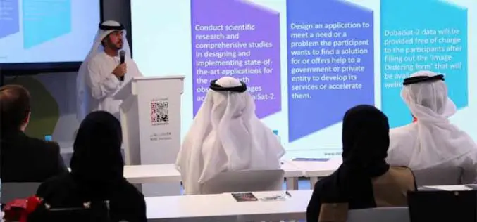
MBRSC Launches Remote Sensing Applications Competition
The Mohammed Bin Rashid Space Centre (MBRSC) launched the 2015 edition of the Remote Sensing Applications Competition (RSAC), which aims to promote scientific research and applications that use satellite images

GIS
Innovative Remote Sensing Applications Developed by Masdar Institute to be Implemented by Mohammed Bin Rashid Space Centre
Students and faculty from the Masdar Institute of Science and Technology have won top prizes for their innovative applications of high-resolution satellite data as part of a competition held by
