V.O. Chidambaranar Port Becomes India’s First Major Port to Deploy a Geospatial Digital Twin
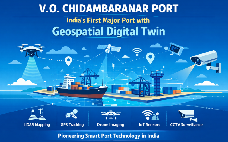
India has taken a major step in smart port infrastructure: V.O. Chidambaranar Port Trust (VOC Port) in Tuticorin, Tamil Nadu, has become the first Indian major port to implement a full geospatial digital twin platform. Announced by the Ministry of Ports, Shipping and Waterways on 12 March 2026, the initiative integrates LiDAR mapping, GPS tracking, drone imaging, IoT sensors, and CCTV surveillance into a unified spatial intelligence system — marking a significant milestone for geospatial technology adoption in India’s maritime sector.
Background: LiDAR Mapping and Smart Port Initiatives in India
Geospatial digital twins — real-time virtual replicas of physical infrastructure built on geospatial data — have been transforming port management globally. Internationally, ports such as Rotterdam and Singapore’s PSA have deployed geospatial digital twin platforms for years. In India, however, adoption among major ports remained limited until this announcement. VOC Port, which handles one of India’s highest cargo volumes and is the country’s only deep-water port on the eastern coast, was selected as the pilot for the Ministry of Ports’ broader ambition to modernise maritime infrastructure through LiDAR
LiDAR Mapping Technology and Geospatial Digital Twin Methodology
The digital twin platform at VOC Port integrates several advanced geospatial technologies into a single operational dashboard.
LiDAR Mapping, Drone Imaging, and GPS Tracking Integration
LiDAR (Light Detection and Ranging) scanning forms the geometric backbone of the digital twin, capturing precise three-dimensional point clouds of port infrastructure — berths, warehouses, roads, and cargo yards — at centimetre-level spatial resolution. These point cloud datasets are processed into accurate 3D spatial models that update dynamically as physical conditions change. Drone-mounted RGB and multispectral imaging sensors complement LiDAR by providing photorealistic texture mapping and orthomosaic imagery across the port area. GPS-tracked water tankers and cargo vehicles feed real-time positional data into the platform, enabling live traffic management and logistics optimisation. IoT sensor networks embedded in berth infrastructure monitor structural load, tidal fluctuations, and equipment health, feeding data into the spatial model via telemetry pipelines. All data layers are georeferenced to a common coordinate reference system, enabling seamless spatial analysis across departments.
Also Read – What is Digital Twin and How Does It Work?
Implementation: Tuticorin Port, Tamil Nadu
VOC Port spans approximately 265 hectares of operational port land along the Gulf of Mannar coastline, Tamil Nadu. The digital twin covers the entire port precinct including three major cargo terminals, the container yard, rail and road access corridors, and the marine approach channel. Data acquisition involved mobile terrestrial LiDAR mapping surveys of port roadways and warehouses combined with aerial LiDAR from drone platforms for open-yard coverage. The platform is hosted on a cloud-based geospatial data infrastructure and is accessible to port operations managers through a real-time GIS dashboard.
Applications and Impact
The geospatial digital twin enables multiple critical operational improvements. Port managers can simulate cargo movement scenarios, optimise berth scheduling, and model emergency evacuation routes using accurate spatial data. The LiDAR-derived 3D models support structural health monitoring of quay walls and cranes. Environmental compliance is improved through spatial analysis of dredging impacts on the marine ecosystem. Nationally, the VOC Port model is intended as a replicable blueprint for India’s other twelve major ports, potentially transforming the country’s entire maritime geospatial data ecosystem.
Conclusion
The deployment of a LiDAR mapping-enabled digital twin at VOC Port is a landmark achievement for India’s geospatial and maritime sectors. As the country looks to replicate this model across its major ports, the integration of precision spatial data with real-time IoT and drone technology sets a new benchmark for port intelligence — and signals the growing maturity of geospatial infrastructure in Indian public sector operations.
References
1. Press Information Bureau, Government of India. “V.O. Chidambaranar Port becomes First Indian Major Port to Implement Digital Twin.” PIB Press Release, 12 March 2026. https://pib.gov.in
2. Ministry of Ports, Shipping and Waterways, Government of India. Sagarmala Programme — Port-Led Development. https://sagarmala.gov.in
3. V.O. Chidambaranar Port Trust. Official Port Profile. https://vocport.gov.in