
Tag "GPR"
Business
Software
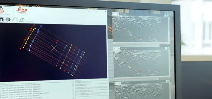
New Utility Post Processing Software Delivers CAD Drawings in Less Time with Professional Results
Leica DX Office Vision enables non-experienced CAD users to digitally map detected underground utilities (Heerbrugg, Switzerland, 14 June 2017) – Leica Geosystems, industry leader in measurement technology, released today its
Remote Sensing
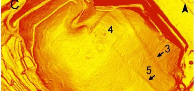
Airborne LiDAR Led To the Discovery of an Early Roman Fortification System
An interdisciplinary study by Federico Bernardini et.al., airborne light detection and ranging (LiDAR), ground penetrating radar (GPR), and archaeological surveys of the archaeological landscape of the Trieste area (northeastern Italy),
