
Tag "Hexagon Imagery Program"
Business
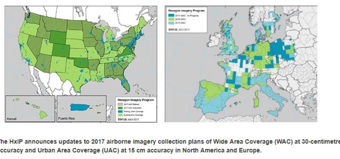
Hexagon Imagery Program Announces Updates to 2017 Airborne Imagery Collection Plans
Latest imagery collection covers U.S., Canada, Europe, plans include territories, cities (WASHINGTON, D.C., Aug. 15, 2017) – The Hexagon Imagery Program (HxIP), the premier source for professional airborne imagery provided

Business
Software
Enhanced Imagery, Modelling, Volumes Improve Productivity With LISTECH Neo
LISTECH, a Hexagon Geosystems brand, today announced increased functionality to its new geospatial software Neo, with terrain modelling, volume calculation and imagery offerings. With an integrated 3D/2D environment for viewing
