
Tag "mapping"
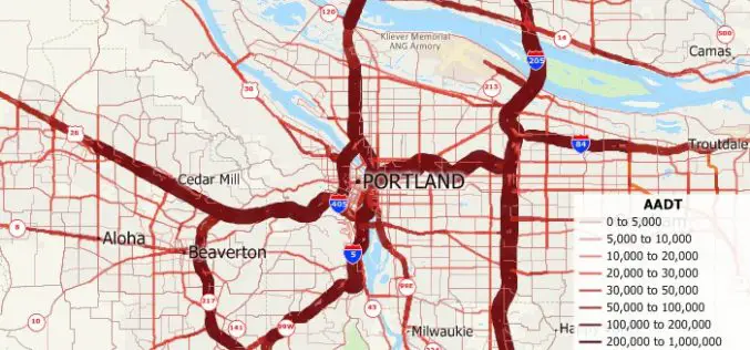
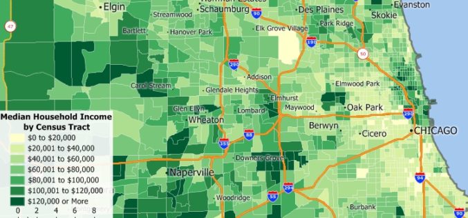
Free U.S. Traffic Count Data for Use with Maptitude 2018 Mapping Software
Newton, Massachusetts (USA) – Caliper is excited to announce the release of free USA traffic count data for Maptitude 2018 users. This latest map layer includes fields with total Annual Average Daily Traffic
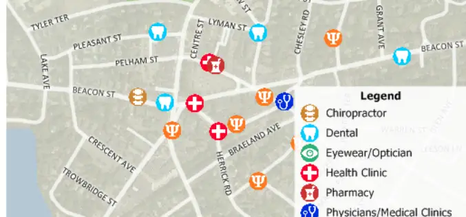
Free Healthcare Data for Use with Maptitude 2018 Mapping Software
NEWTON, MASSACHUSETTS (USA) – Caliper is excited to announce the release of free updated healthcare map layers. We are providing over 5 million medical and healthcare provider points-of-interest. These locations can

3D Laser Mapping & GeoSLAM Global Merger Announcement
3D Laser Mapping Ltd and GeoSLAM Ltd Merge, Creating a Global Market Leader in Mapping and Monitoring Nottingham, England, 1st August 2018 – Leading UK laser scanning and monitoring companies’ 3D
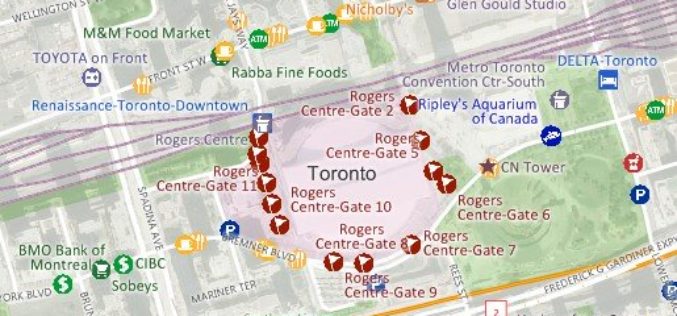
Free Point of Interest Data by Type for Use with Maptitude Mapping Software
NEWTON, MASSACHUSETTS (USA)- July 11, 2018- Free landmark point layers sorted by category are available for users of Maptitude 2018 and the United States, Australia, Canada, or United Kingdom Country Packages.
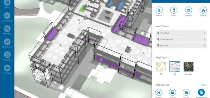
Esri Announces New Indoor Mapping Product
Redlands, California, June 9, 2018 – Esri , the global leader in location intelligence, today announced it will release ArcGIS Indoors, which will enable interactive indoor mapping of corporate facilities, retail and commercial

TomTom Mapping Data to Power End-To-End Analytics Platform
Alteryx customers can now accelerate development of data science and analytic models with TomTom’s Map Data and APIs Amsterdam, the Netherlands, June 29 2018 – TomTom (TOM2) today announced that
New 2018 Country Packages for the USA, Australia, Brazil, Canada, Mexico, New Zealand, and UK & Ireland
NEWTON, MASSACHUSETTS (USA) – Caliper is excited to announce the release of new 2018 Country Packages for its Maptitude mapping software. Maptitude Country Packages bring the power and flexibility of our
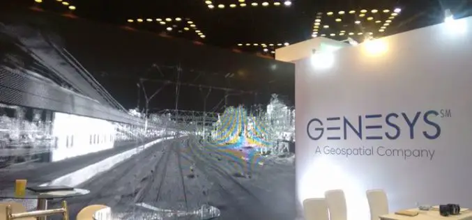
Genesys International Corporation Ltd Bags Prestigious TAPI Mapping Project Using LIDAR
Genesys International Corporation Ltd has been awarded the prestigious TAPI mapping project using LIDAR. won against international competition – this project win is an extension of the company’s expertise in
Maptitude Mapping Software Team Provides Corporate Sponsorship for NEGIS Spring Conference
NEWTON MA (USA) – The Northeast Geographic Information Society (NEGIS) Spring Conference was held on April 26, 2018 in Boston, Massachusetts. NEGIS is a charitable organization whose purpose is to
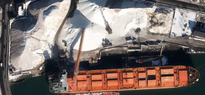
Col-East Inventories Salt Piles from the Air Each Winter in Preparation for Snowy Weather
NORTH ADAMS, Massachusetts, 20 March 2018 – Surveying and Mapping Consultants Inc. (SMC) of Braintree, Mass., has teamed with Col-East International Ltd. for the past 12 years to monitor inventories
