
Tag "Oman"

GIS
Oman Begins Comprehensive Flood Risk Mapping to Enhance Safety
Oman is initiating a major project focused on Flood Risk Mapping across the country. The Ministry of Agriculture, Fisheries, and Water Resources has engaged a specialized company to lead this

Business
Ordnance Survey to Map Oman’s World Class Geospatial Path
Ordnance Survey (OS) has signed a deal with the Sultanate of Oman Ministry of Defence to help the National Survey Authority (NSA) advance its position as Oman’s national mapping authority. This
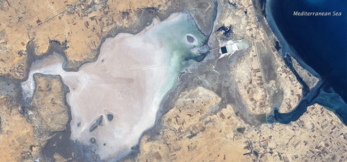
GIS
Remote Sensing and GIS to Study Geomorphology of Al Batinah
In recent news, researchers are using GIS and remote sensing technology to examine the Sabkhas and tidal inlets in Al Batinah plain. Sabkha is a transliteration of the Arabic word for a salt flat. Sabkhas are supratidal,
