
Tag "OS maps"
Explore Great Britain with OS’s Ultimate Adventure Planning Tool
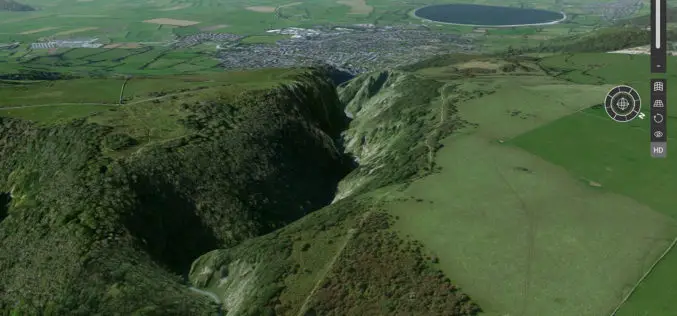
Fresh from being named the UK Outdoor Industry’s Digital Product of the Year, OS Maps has become even better with the inclusion of an immersive 3D view of Great Britain in
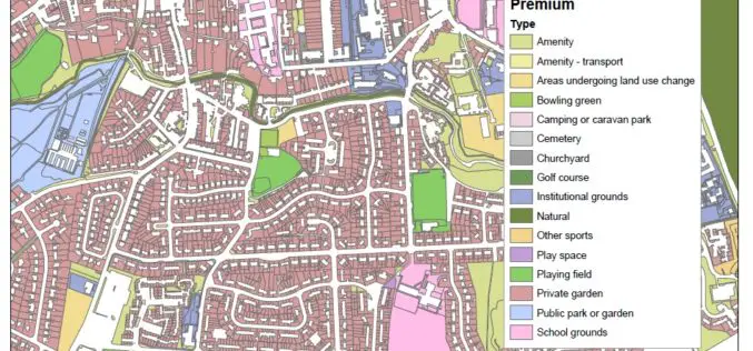
New Dataset of Accessible Greenspace for Scotland
A new digital map of every publicly accessible greenspace in Scotland will be released in March 2017. Recently the Ordnance Survey (OS) and the Scottish Government released an update on the project

OS Maps Play a Role in the New UK Passports
The latest UK passport design was released yesterday and we’re extremely pleased to see a range of mapping from OS OpenData across the pages. Launched at Shakespeare’s Globe in London, the
Digimap for Schools Launches 1950s Maps of Great Britain
Digimap for Schools now has a second historic map layer added to its popular online service, giving teachers and pupils direct access to Ordnance Survey mapping from three centuries. Covering the
