
Archive
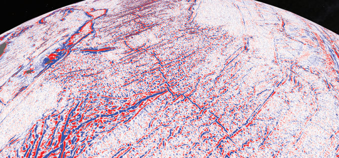
Satellite Maps Reveal Small Tectonic Plate in the Indian Ocean
A team of Australian and U.S. researchers has found a small tectonic plate or microplate in the Indian Ocean. Using Satellite maps, researchers discovered the Indian Ocean microplate, called Mammerickx Microplate and measuring

Webinar Series: Get More from UAV Imagery
Get More From Imagery Webinar Series: Get More from UAV Imagery Dec. 03, 2015 at 4am EDT (9am GMT) | Dec. 03, 2015 at 2pm EDT (7pm GMT) PCI Geomatics is the
GRASS GIS 7.0.2 Released
GRASS GIS is pleased to announce the new stable release of GRASS GIS 7.0.2 The new GRASS GIS 7.0.2 release provides 190 stability fixes and manual improvements. About GRASS GIS 7: Its graphical
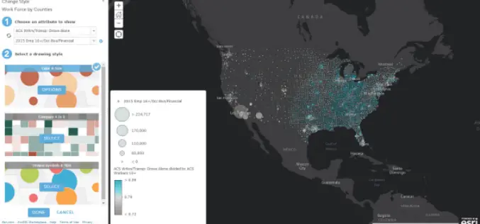
November Update of ArcGIS Online Features
Esri has released the November 2015 update for ArcGIS Online features, which includes new options for visualizing your data, enhancements to administering your organization, and improvements to the design of the
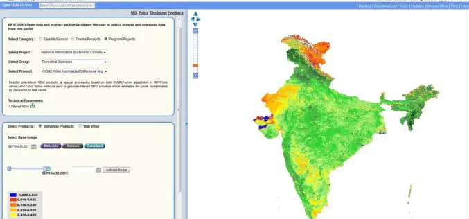
Bhuvan Updates | OGC Services, Active Agricultural Fire Locations, Snow Albedo, Filtered NDVI
Bhuvan, (lit: Earth), is a software application which allows users to explore a 2D/3D representation of the surface of the Earth. The browser is specifically tailored to view India, offering
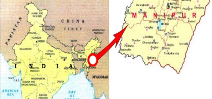
Manipur Has Launched ‘Make In Manipur’ and GIS Mapping for Sericulture Activities
Imphal – Manipur government has launched ‘Make in Manipur’ and GIS mapping for sericulture activities in the region. The move aimed to woo investors and generate employment in the state. Manipur

China Launches Yaogan-29 Remote Sensing Satellite
China has successfully launched a remote sensing satellite named was carried by a Long March – 4C rocket after it was launched on Thursday from Taiyuan in the country’s northern Shanxi

5th EnMAP School on Hyperspectral Remote Sensing
The EnMAP Science Advisory Group (EnSAG) organizes the 5th EnMAP School at Trier University in April 2016. We are pleased to host the EnMAP School in Trier for the second
CartoDB’s Location Intelligence Platform Continues Revolutionizing the Future of Smart Cities
Mexico City and CartoDB unveil the company’s largest civic location intelligence project to date at the Smart City Expo World Congress in Barcelona CartoDB unveiled the initial phases of a
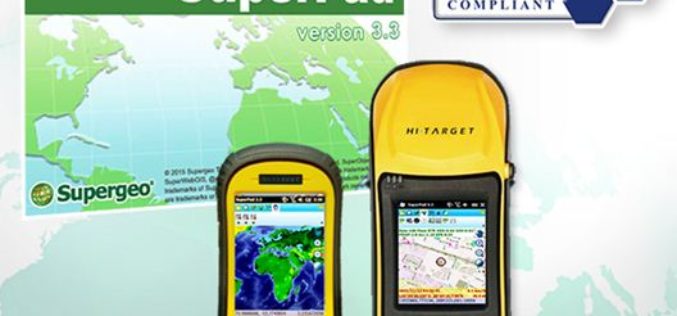
Get Ready for Best Mobile GIS Solution on Windows Mobile Platform Ever!
The product team at Supergeo is getting ready to launch an updated version of SuperPad 3.3! The usability and reliability have been improved, and we have included some robust and
