
Tag "satellite"
Russian Space Systems to Launch Resurs-P No. 3 Remote Sensing Satellite
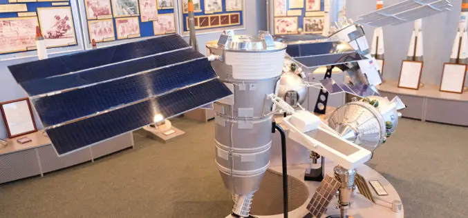
MOSCOW- According to recent news by the Sputnik, Russian Space Systems company said that launch of Russia’s Resurs-P No. 3 remote sensing satellite has been scheduled for March 12. The Resurs-P

Airbus Defence and Space and OneWeb create OneWeb Satellites Company – the Next Stage of the OneWeb Adventure
– OneWeb Satellites is a joint venture equally owned by Airbus Defence and Space and OneWeb – Company to design and build 900 satellites for OneWeb, as well as satellites
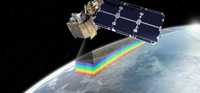
ESA Selects Airbus Defence and Space for Two New Sentinel-2 Satellites
Airbus Defence and Space is prime contractor for the €285M order Additional Sentinel-2 satellites will join Europe´s Copernicus Earth observation programme Airbus Defence and Space, the world’s second-largest space company,

Saudi Arabia to Launch Remote Sensing Satellite from China
Riyadh — King Abdulaziz City for Science and Technology (KACST) is working to complete preparation of the components of the Saudi satellite (Saudi SAT 5B) which is locally made, in
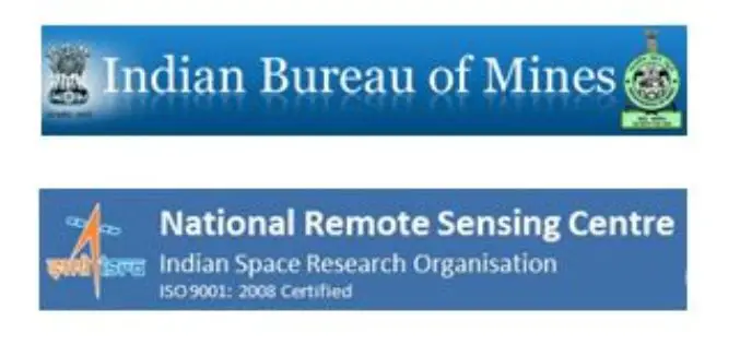
IBM and NRSC Signed MoU for Monitoring Mining Activity
According to recent news, Indian Bureau of Mines (IBM) and National Remote Sensing Centre (NRSC) has signed Memorandum of Understanding (MoU) for monitoring mining activity through satellite technology. The MoU was
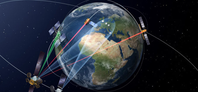
Launch of the First Satellite in the “SpaceDataHighway” Programme
SpaceDataHighway will provide high-speed laser communication in space of extremely high volumes of data transfer, up to 50 terabytes per day EDRS-A, the first relay satellite in the SpaceDataHighway programme

China Plans to Build Remote Sensing Satellite Network with Global Coverage
China is planning to build a remote sensing satellite network with global coverage by setting up more ground stations overseas. The move will enable China to provide diversified data to foreign
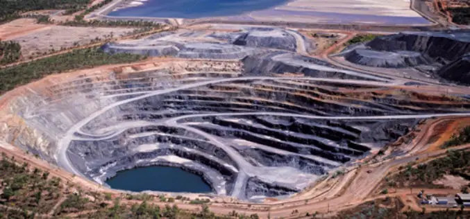
Indian Government Plans to Track Illegal Mining Using Space Technology
NEW DELHI: The government has finalised its plans to track illegal mining in the country using space technology and satellite imagery in partnership with Indian Space Research Organisation (ISRO). This
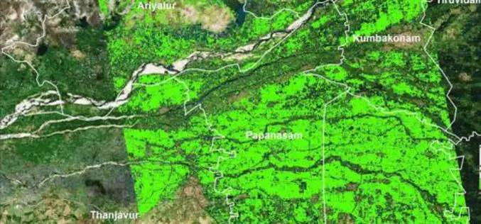
Researchers from TNAU Uses Satellite Images for Crop Management
According to recent news by The Hindu, researchers from Tamil Nadu Agricultural University (TNAU), Coimbatore, have calculated how much-cultivated area was inundated in the recent rains hit hard the costal

ISRO Has Launched Remote Sensing Satellites in Thematic Series, Says Jitendra Singh
New Delhi, India Dec. 9: Union Minister of State for Space Jitendra Singh on Wednesday informed the Lok Sabha that Indian Space Research Organisation (ISRO) has launched Remote Sensing Satellites
