
Tag "satellite"
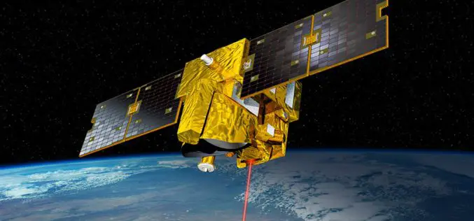
German-French MERLIN Mission at COP 21- Paris
On Tuesday 8 December at the 2015 UN Climate Change Conference COP 21 in Paris, the German Aerospace Center (Deutsches Zentrum für Luft- und Raumfahrt; DLR) and the French space agency

UK and China to Monitor Bridge Movement Using Satellite
The University of Nottingham (UK) has signed up a MoU with the huge construction conglomerate China Railway Group to develop and commercialise advanced satellite techniques to monitor the structural integrity

China to Launch Satellite to Help With Emission Reduction
China is planning to launch a satellite in 2016 to monitoring the global distribution of atmospheric carbon dioxide. This will be first of its kind in China, the satellite, tentatively called
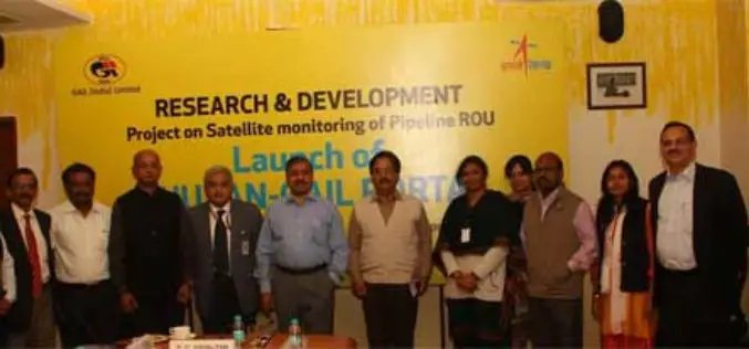
GAIL and ISRO Joins Hands for Satellite Monitoring Of Pipelines
To address pipeline safety concerns, GAIL (India) Limited in collaboration with National Remote Sensing Centre (NRSC) – a unit of Indian Space Research Organization (ISRO) – has launched an innovative

TerraSAR-X and RADARSAT-2 to Improve Monitoring Over North Canadian Region
– The German Aerospace Center (DLR) has awarded Airbus Defence and Space with two research projects to enhance Emergency Preparedness and Safety of Operations in collaboration with Canadian partners –

CIDCO to Fight Encroachments Using Satellite Mapping
Navi Mumbai: The City and Industrial Development Corporation of Maharashtra (CIDCO) has tied up with a Central government agency, which will provide satellite mapping every fortnight keeping an eye on
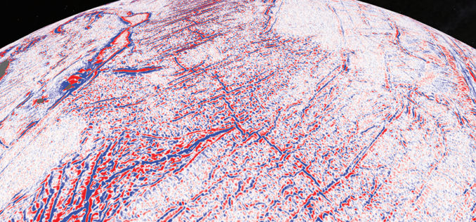
Satellite Maps Reveal Small Tectonic Plate in the Indian Ocean
A team of Australian and U.S. researchers has found a small tectonic plate or microplate in the Indian Ocean. Using Satellite maps, researchers discovered the Indian Ocean microplate, called Mammerickx Microplate and measuring
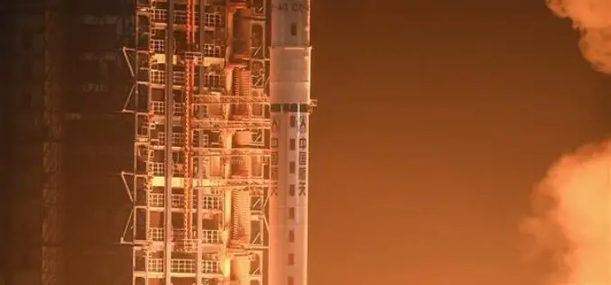
China Launches Yaogan-29 Remote Sensing Satellite
China has successfully launched a remote sensing satellite named was carried by a Long March – 4C rocket after it was launched on Thursday from Taiyuan in the country’s northern Shanxi

GAIL to Use Drones, Satellite Mapping To Monitor Pipeline Network
GAIL (India) Ltd has decided to use drones and satellite imagery to map and monitor its pipeline network while expanding its Sahyogi (partner) scheme to detect/prevent encroachment and terror attack

ESA Issues Call For New Earth Explorer Proposals
ESA is announcing an opportunity for scientists involved in Earth observation to submit proposals for the next potential Earth Explorer satellite mission. Traditionally, Earth Explorers use new measurement techniques to
