
Tag "Topographic Map"

China Draws 3D Topographic Map of Antarctic Seabed
Chinese scientists have created a three-dimensional, digital topographic map of the Antarctic seabed using data collected during a recent expedition. The map was presented at a press briefing held Friday
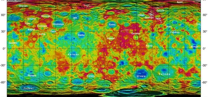
Dwarf Planet Ceres – New Name, New Maps, New Questions
This week, scientists at the European Planetary Science Conference (EPSC) in Nantes, France are busy with the mysterious crater structures and fascinating views of the multifaceted dwarf planet Ceres. The

NSF and NGA Support Development of New Topographic Maps of the Arctic
The National Science Foundation (NSF), in partnership with the National Geospatial-Intelligence Agency (NGA), is supporting development of high-resolution topographic maps of the Arctic that for the first time will provide

GeoShot Technologies Completed Large City Modeling Project Using LiDAR Data
GeoShot Technologies has successfully completed large city modeling using LiDAR data. “We are very excited to complete the first large scale city modeling project at GeoShot Technologies at a time

New York to LA: History of America’s Maps in One App
Redlands, California—Two of the nation’s most authoritative mapping sources, the U.S. Geological Survey and Esri, have partnered to put the rich tapestry of U.S. Historical Maps into the hands of
