
Archive

Watering the Future – Manage Natural Resources by SuperGIS Cross-Platform Solution
Webinar: Watering the Future – Manage Natural Resources by SuperGIS Cross-Platform Solution 7th May, 11:00 AM (New York Time) Your Local Time (http://goo.gl/LYUae8) Wondering how to manage natural resources efficiently? With the

PCI Geomatics Announces Release of Geomatica 2015
MARKHAM, Ontario, Canada—April 28, 2015: PCI Geomatics, a world leading developer of geo-imaging software and systems, today announces the release of Geomatica 2015; the latest version of the company’s complete

INTERGEO Offers New Showcase For UAS Exhibitors
Integrated “interaerial SOLUTIONS” platform and partnership with “UAV DACH” association unveiled Stuttgart / Karlsruhe – INTERGEO’s integrated “interaerial SOLUTIONS” platform is a response to the rapid development in data acquisition,
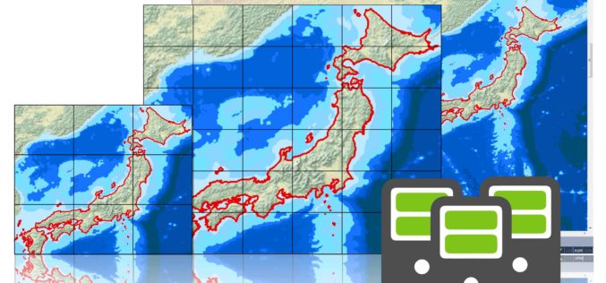
Brand New SuperGIS Desktop 3.3, Now Released for Worldwide Users!
SuperGIS Desktop 3.3, the powerful GIS software developed by Supergeo, is officially released! The latest version enhances map drawing, geodatabase, cache generator and data processing functions. By using SuperGIS Desktop

Hong Kong Planning Department Selects SuperSurv (Android) for Future City Plan
Supergeo Technologies, the leading GIS software and solution provider, announces that the Planning Department in Hong Kong purchased the mobile GIS app, SuperSurv for Android, and is now evaluating the
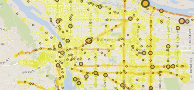
Portland has Mapped Every Reported Traffic Injury From 2004-13
Various organizations have tried their hand over the years at mapping Portland’s traffic-safety hot spots. Now, the city has created a map of its own. It might be the best one
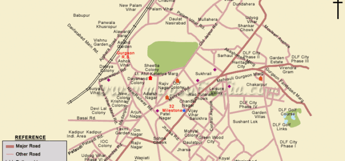
Government Plans to Develop Gurgaon into Smart City
According to recent news by ToI, senior officials of various government authorities (district administration, MCG, HUDA, power discom DHBVN and functionaries of PGCIL) had a meeting to prepare the framework

Trimble Expands Storage Tank Inspection and Pipeline Measurement Portfolio for Geospatial Professionals in Oil and Gas
New Integrated Scanning Technology for Storage Tanks and Pipeline Analysis and Modeling Solutions Enables Increased Productivity SUNNYVALE, Calif., April 23, 2015—Trimble (NASDAQ: TRMB) announced today an expanded geospatial portfolio that

IRE, Esri Together to Offer Fellowships For Mapping Training
IRE and Esri have partnered to offer fellowships to attend mapping training at the 2015 Esri Conference from July 18-22 in San Diego or the IRE Mapping Boot Camp from August 7-9 at the University of Missouri-Columbia,
Esri Partners with NLC to Spur Government Innovation
Esri Open-Source Code and Open Data Give Developers Tools to Build Smart Communities Redlands, California—As part of its commitment to build smart communities, Esri is supporting the National League of
