
Archive
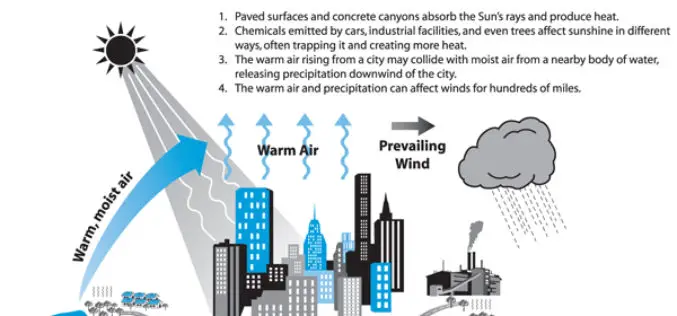
Analysis of the Urban Heat Island Effect in Shijiazhuang, China Using Satellite and Airborne Data
Analysis of the Urban Heat Island Effect in Shijiazhuang, China Using Satellite and Airborne Data – Kai Liu, Hongbo Su, Lifu Zhang, Hang Yang, Renhua Zhang and Xueke Li Abstract: The urban heat island (UHI)
Mapmakers Invited to Submit Best of the Best – Esri’s Storytelling with Maps Contest
Esri Launches Worldwide Storytelling with Maps Contest Redlands, California—Mappers everywhere who harness the power of geographic information system (GIS) technology to tell their stories can now enter Esri’s Storytelling with

Drone to Spread Beneficial Bugs on Crop
University of Queensland agricultural science student Michael Godfrey has developed a drone that spreads beneficial insects onto crops, potentially saving farmers time and money. During his Summer Science Scholarship, Mr

3D Laser Mapping to Revolutionise Building Surveys
3D Laser Mapping has launched a powerful solution that will revolutionise the production of highly accurate building floor plans. Combining the easy to use ZEB1 hand held laser mapping system
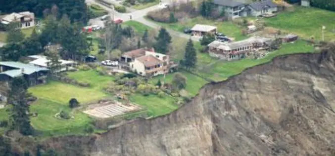
Washington State to Use LiDAR for Mapping of Geological Hazards
OLYMPIA, Washington – Gov. Jay Inslee has signed a bill that will allow Washington to have more information than ever about geologic hazards that threaten communities and citizens. Senate Bill
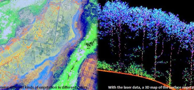
Protecting Nature Using Airborne Laser Footprint Data
In a study by Prof. Norbert Pfeifer at the Vienna University of Technology, reveals the significance of using airborne laser technology in protecting nature. The study area is ‘‘Nagyerdo˝’’ (Great

USGS Continues to Write History
New Volume of Agency Annals Released The fourth volume of the comprehensive history of the U.S. Geological Survey, Minerals, Lands, and Geology for the Common Defence and General Welfare: Volume

Esri India Webinar: Location Analytics for Insurance
Esri India Webinar: Location Analytics for Insurance Tuesday, April 28, 2015 1:30 pm (IST) Insurance is a location centred business. Helping customers mitigate loss relies heavily on location information. When
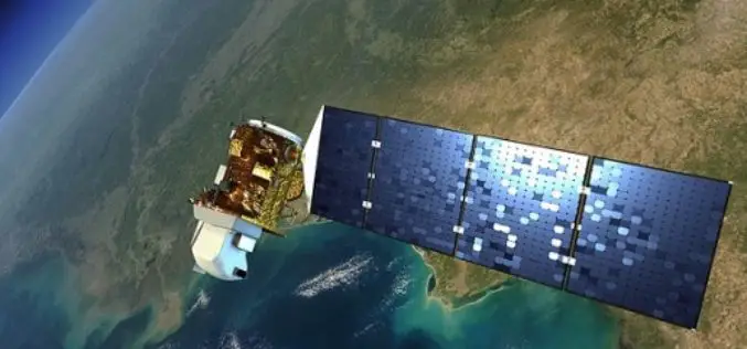
Landsat 9 to Continue Land Imaging Legacy of the U.S. Space Program
In recent news update by NASA, NASA and USGS are working together on Landsat 9, schedule to launch in 2023. NASA will build, launch, perform the initial check-out and commissioning
Esri and Safe Software Release Common Framework for Data Exchange among Electrical Power Utilities
Common Information Model Translation Template Enables Data Exchange from GIS to Internal and External Enterprise Systems Redlands, California—Esri and Safe Software have paired to develop and openly share a Common
