
Archive
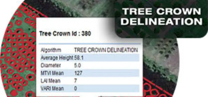
Tree Crown Delineation a New App to Monitor Trees
The latest drone app, Tree Crown Delineation automatically identifies individual tree crowns in your aerial survey. It also generates a geospatial layer of tree crowns with overall health level and

DigitalGlobe’s Basemap Suite Expands to Include 250 Million Square Kilometers of 30 cm Imagery
More than 500 population centers now feature the world’s highest resolution commercial satellite imagery WESTMINSTER, Colo.–(BUSINESS WIRE)–Sep. 28, 2016– DigitalGlobe, Inc. (NYSE: DGI), the global leader in Earth imagery and

Bihar the Most Flood-prone State of India Aided by New Satellite Mapping
BHUBANESWAR, India (Thomson Reuters Foundation) – Every year Bihar is deluged by floods that submerge roads, destroy homes and wash away crops, leaving the disaster management authority struggling to monitor

Esri Becomes Ambassador of NOAA and NWS Weather-Ready Nation
GIS Role in NOAA Weather Data Portal Key to Designation Redlands, California—Esri, the world leader in geographic information system (GIS) technology, today (September 27, 2016) announced its participation in the
New Leica iCON Roller Secures Long-lasting Quality, Improves Productivity
Leica Geosystems, industry leader in measurement technology, released today (27 September 2016) its new iCON roller, providing contractors with the solution to achieve constant and effective compaction on any work
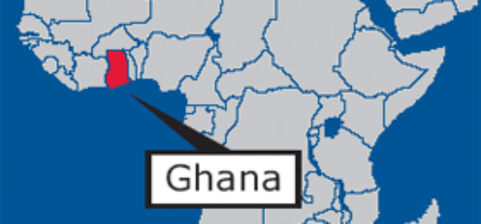
GIS Data Hub Established in Cape Coast: Ghana
According to the recent news reported by the Ghana Business News, a Geographic Information System (GIS) Data Hub has been created for the Department of Town and Country Planning in Cape
DAT/EM Systems International Releases Software Version 7.3
Anchorage, Alaska, USA. September 27, 2016 – DAT/EM Systems International® announces the release of the 7.3 edition of DAT/EM software products. Updated products include Summit Evolution™ 3D photogrammetric workstation, LandScape™ 3D point

Esri Chosen by Microsoft as its GIS Service for Enterprise Users
A New World of Analytics Available to Power BI and Azure Users Redlands, California—Esri, the world leader in geographic information system (GIS) technology, is collaborating with Microsoft Corp. on two
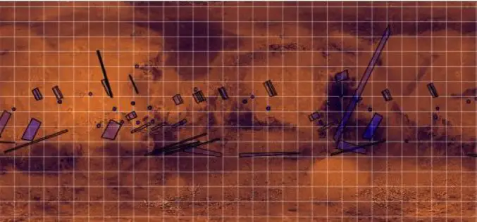
ISRO Released Data of Mars Orbiter Mission (MOM)
On September 24, 2016, Chairman, ISRO and Secretary, Department of Space has released the first year of MOM Long-term archive data for the duration of Sept 24, 2014, to Sept 23, 2015,

India Successfully Launches SCATSAT-1 – Satellite for Weather Forecasting
SCATSAT-1 is a global mission and data generated from the Scatterometer, developed by ISRO will also be utilised by the American space agency NASA and European Space Agency organisation, EUMETSAT
