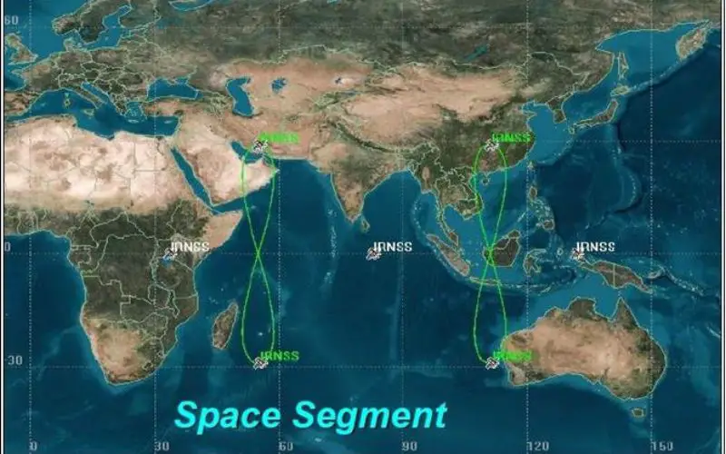
India’s navigation capabilities are advancing as ISRO expands NaVIC (Navigation with Indian Constellation) to civilian use and access to mobile phones. NaVIC, formally known as IRNSS, which comprises seven satellites – consists of three Geostationary Earth Orbit (GEO) spacecraft and four spacecraft in Geosynchronous orbit inclined at 29 deg – offers comprehensive regional coverage.
NavIC offers impressive precision, with location accuracy within 10 meters across India and up to 20 meters in nearby regions. Such precise accuracy is essential for many uses, like navigation, mapping, and location-based services. The system uses dual frequencies—L5 (1176.45 MHz) and S-band (2492.028 MHz)—which enhances navigation accuracy.
Recent updates by Qualcomm have enabled NaVIC compatibility in mobile phones, allowing direct signal reception. This new capability eliminates the need for additional hardware, enabling users to benefit from NaVIC’s precision.
Also Read – Towards Self Reliance in Satellite Navigation-IRNSS
The future of NaVIC involves launching new satellites using the L1 frequency band, further broadening accessibility to mobile users. One such satellite has already been launched, signaling a step towards an independent and robust Indian navigation system.
NaVIC provides two types of services, namely, Standard Positioning Services (SPS) – provided to all users – and Restricted Services (RS), provided to authorized users as it is an encrypted service.
Also Read – Everything You Need To Know About GPS L1, L2, and L5 Frequencies
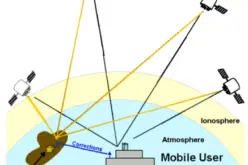
The IRNSS user receiver calculates its position using the timing information embedded in the navigation signal, transmitted from the IRNSS satellites. The timing information being broadcast in the navigation signal is derived from the atomic clock onboard the IRNSS satellite.
NaVIC not only supports everyday navigation and mapping but also enhances India’s strategic autonomy by providing a reliable alternative to global systems like GPS.
This effort aligns with India’s goal of establishing an independent, indigenous navigation solution that meets both civilian and strategic needs with high precision.
Source: ET Now