
Posts From GIS Resources
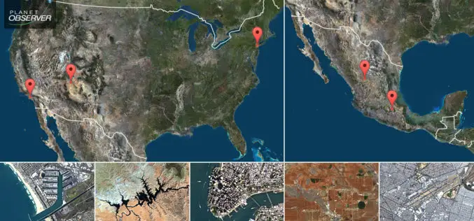
PlanetObserver Presents New PlanetSAT Updates Imagery Basemap of the United States and Mexico
Clermont-Ferrand, France – April 26th 2017 – The French company PlanetObserver, specialized in geospatial data production, has just finalized the new PlanetSAT Updates imagery basemap of the United States and

Bulgaria and Macedonia Agreed to Exchange Cartographic and Geodetic Data
According to recent news reported by novini.com, the Republic of Bulgaria and Republic of Macedonia have agreed to exchange geodetic, cartographic, and cadastral data. The Memorandum of Cooperation (MoC) was signed on November 23, 2017, for

Pix4D Partners with Kokusai Kogyo in Japan to Deliver a 3D Geospatial Analysis Cloud Service
Full automation for 3D spatial analysis that support i-Construction and public surveying November 20, 2017 – Pix4D is partnering with Kokusai Kogyo Corporation (KKC)—the leading geospatial consulting company in Japan–to deliver

China Launches Three Remote Sensing Satellites – Jilin-1-04, Jilin-1-05 and Jilin-1-06
November 21 (ANI): China has launched three remote sensing satellites to promote commercial use for the remote sensing industry. The satellites — Jilin-1-04, Jilin-1-05, and Jilin-1-06 — were carried by a
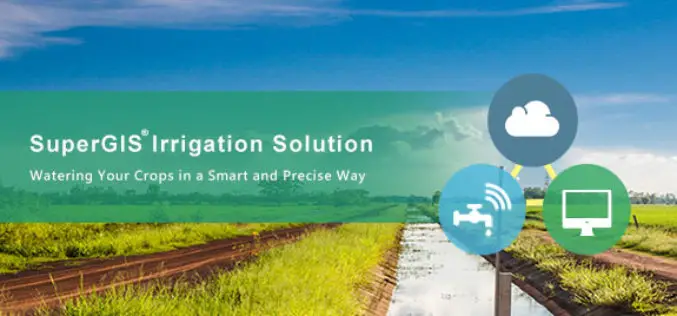
Supergeo Partners with Agricultural Engineering Research Center to Develop Irrigation Solution
Supergeo is excited to announce that Agricultural Engineering Research Center (AERC), the leading research institute in irrigation study, has collaborated with Supergeo to develop an irrigation solution based on SuperGIS
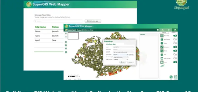
Building a Unique GIS Website without Coding by Brand New SuperGIS Server 10
Supergeo, the global leading GIS software provider, is glad to announce its brand-new GIS server software, SuperGIS Server 10, is expected to be launched in the mid-November! Inheriting the high

OGC Calls for Participation in its ‘Geospatial to the Edge’ Interoperability Plugfest
November 21, 2017 – The Open Geospatial Consortium (OGC) is calling for interested participants in its ‘Geospatial to the Edge’ Interoperability Plugfest. OGC Plugfests, initiatives of the OGC Innovation Program, provide

Global Mapper SDK Now Available on Amazon Web Services
Hallowell, Maine – November 16, 2017 – Blue Marble Geographics (bluemarblegeo.com) is pleased to announce that the Global Mapper Software Development Kit (SDK) has been expanded to provide data processing capabilities

Global Analysis and GIS Forecast in the Telecommunications Market in 2017-2023
Report “GIS in the telecommunications market by type (software and services), deployment models (cloud and local) and the end user (small and medium business and large enterprises); Global Opportunity Analysis

DLR at Agritechnica in Hanover – Assistance from Space: Satellite Data for Digital Agriculture
Satellite information facilitates the modern management of agricultural land Agritechnica is the world’s largest trade fair for agricultural machinery, with 2900 exhibitors from 52 countries and 450,000 visitors (2015) Focus:
