
Posts From GIS Resources
Facebook Launches Disaster Maps to Help Communities Recover and Rebuild
According to recent news by the Facebook Newsroom, Facebook is introducing disaster maps that use aggregated, de-identified Facebook data to help organizations address the critical gap in the information they often
Esri ArcGIS 10.5 Leading Platform in OGC Compliance
The Transformative Software Receives over 30 OGC Compliance Certificates June 7, 2017 – Redlands, California—Esri, the global leader in spatial analytics, today announced that it has received over 30 compliance

Harris Corporation Provides Industry Training to National Geospatial-Intelligence Agency Employees
Highlights: Participants learn Harris workflows, innovative technologies, and commercial processes Best practices delivered via Harris Geospatial Innovation Center Program part of long Harris-NGA collaboration on geospatial technology solutions June 7,
New Open-source Software Enhances Satellite Geodesy Capability
Scientists from Geoscience Australia have released new software that will improve the ability to process big remotely-sensed satellite datasets. The new “PyRate” software being presented this week at the European
BAE Systems Enhances Geospatial Software by Adding Movement Intelligence Capabilities
SAN DIEGO–(BUSINESS WIRE)–BAE Systems has integrated capabilities called Movement Intelligence, or MOVINT, into its Geospatial eXploitation Products™ (GXP®) line of software, helping analysts to more easily identify intelligence threats using
DigitalGlobe Makes MDA’s RADARSAT-2 Data Available on the Geospatial Big Data platform
WESTMINSTER, Colo.–(BUSINESS WIRE)–Jun. 5, 2017– DigitalGlobe, Inc. (NYSE: DGI), the global leader in Earth imagery and information about our changing planet, today announced an agreement with MacDonald, Dettwiler and Associates
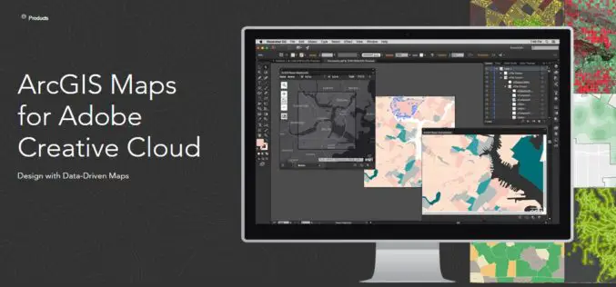
Esri Announce the Release of ArcGIS Maps for Adobe Creative Cloud!
The ArcGIS and Adobe® integration opens GIS up to an expanding group of design- and communications-focused users, who can now make direct use of spatial information. Cartographers can have the
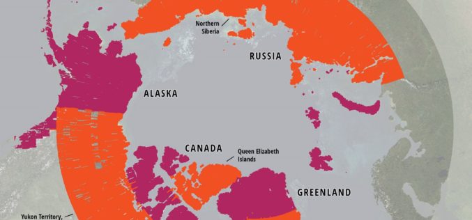
ArcticDEM Project Has Now Mapped More Than 65 Percent of The Arctic
ArcticDEM Release 5 represents the largest release of elevation data to date, more than doubling the number of available strip DEMs, mosaic tiles and geographic coverage area of all releases
Japan Launches Satellite Carrying Its Own Version of GPS
Japan has recently launched a rocket carrying a satellite with a local version of the US global positioning system (GPS) (Quasi-Zenith Satellite System) on Thursday (June 1, 2017), which is expected
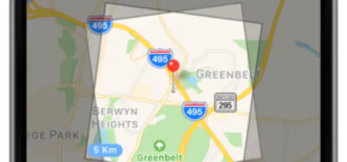
SAR and 40cm Optical Satellite Imagery Tasking With SpyMeSat Mobile App
GREENBELT, MD (June 1st, 2017) – Orbit Logic announced today that SpyMeSat mobile app users can now send new tasking requests to the KOMPSAT-5 Synthetic Aperture RADAR (SAR) imaging satellite
